Cave Campground California

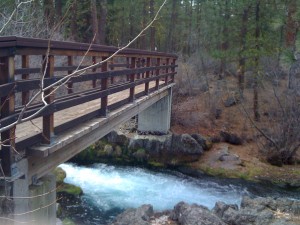
Creek running through Cave Campground

Junct. of Hwy 89 and Hwy 44
Hat Creek, CA

Part of the Lassen National Forest, Cave Campground near Hat Creek makes for a nice pit stop along Hwy 89, especially if you only have time for a bathroom break and maybe a picnic lunch. (If you have more time at your disposal, consider hiking to the falls at nearby McArthur Burney State Park.)

The campground, open with full services April through October, was empty of overnighters when we stopped in March. The larger restroom facilities at the front of the campground were locked, but pit toilets were available at the end of the loop (a few hundred yards away). With no fee for day use, Cave Campground was a great spot to picnic, with easy access to the highway and a stream (rushing in springtime) with a footpath bridge the kids enjoyed exploring. We just pulled into an empty campsite and used the picnic table! (During the busier summer months, day use visitors can use the picnic tables near the front of the campground.)

Date last visited: March 2010

Distance off the interstate: Directly off Hwy 89.

Hours and Admission Prices: No day use admission fee. Overnight fee from April to October is $11 per night.

Bathrooms: See above.

Food Services: None. Closest convenient food is Susanville (another 1.5 hours south).

Website: None.

Directions: Directly off of Hwy 89 just before the junction of Hwy 44 (driving south).

View Larger Map

Cantrall Buckley County Park

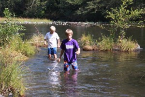
Wading in the river at Cantrall Buckley.

Cantrall Road
Ruch, Oregon

If you’re exploring the pioneer town of Jacksonville (10 minutes off I-5) and have more time to spend, drive out into the Applegate Valley and visit Cantrall Buckley County Park. Set on the shores of the Applegate River, Cantrall Buckley has a long, sloping lawn and picnic areas. The river is slow-moving in this area and great for wading, minnow-fishing (bring nets!) and inner tubing or rafting. Wear water shoes (the pebbles on the river bottom are slippery!) and bring cash for the $4 parking fee.

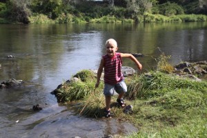
Toby finding crawdads and minnows!

There’s a little playground right across the road from the river as well. It’s an older one, so be careful of hot metal in the summertime. Dogs welcome on a leash.

Date last visited: September 2009

Distance off the interstate: 30 minutes

Hours and Admission Prices: $4 admission to the county park, open sunrise to sunset.

Bathrooms: Located by the playground.

Dogs welcome!

Food Services: None. There’s a fun drive-through ice cream and coffee stand in nearby Ruch, or better yet, hold off and eat hamburgers and onion rings at Jasper’s, located on California Street in Jacksonville (on the way back out to I-5).

Directions: From I-5: Take the Phoenix/Jacksonville exit (south of Medford). Turn right on US Hwy 99 to South Stage Road. Left on South Stage to Jacksonville. Turn right at E California St/OR-238 W and continue 9 miles. Turn left at Hamilton Rd, then take the 2nd right onto Cantrall Rd. Follow signs.

This post part of Photo Friday at www.deliciousbaby.com!

Moab, Utah and Arches National Park

Since not all great places to stop with kids are along the major interstates, Pitstops for Kids! has added a new series called Off the Beaten Path.

First up, beautiful Moab, Utah and its surrounding areas. We had the pleasure of visiting Moab while touring national parks of the southwest, and quickly realized we could have happily spent many more than the one night we’d reserved in the town. Located 45 minutes from I-70 in Utah along US Highway 191 (2 hours from Grand Juncton, Colorado), Moab is one part champion of the arts, one part gateway to adventure and three parts sun-baked natural beauty.

Moab, Utah and Arches National Park:

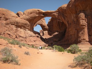
Double Arch in Arches National Park…great for climbing and hiking!

Why it’s worth the drive: Moab is home to both Arches National Park and Canyonlands National Park, which showcase some of the most stunning geological formations we’ve ever seen! Arches in particular is breathtaking, and offers many easy hikes and vista points for kids to explore. We started at the overlook for Delicate Arch (an easier hike with great views), then drive the short distance to Double Arch. You’ll see the visitor’s center directly after entering the park, but do that last when the temperatures rise. (General Tip: whatever your activity, get up and go early; later in the day, temperatures can be unbearable in summer.)

The town of Moab has much to offer in and of itself. If your kids will tolerate such activities, there’s ample shopping (for everything from boutique clothing to high end outdoors equipment to fine art). If you’re up for some adventure, rent bicycles and explore the area on the many trails or book a dune buggy or Jeep expedition to see more of the desert. Read more about our impressions of Moab.

Chuck-wagon style dinner at the Bar M

Date last visited: July 2009

Distance off the interstate: 45 minutes.

Hours and Admission Prices: The National Parks charge $10 per vehicle. Hours vary by season. Check the official websites for more information. There are many hotel and motel options. We stayed in the Days Inn Moab (426 N. Main), which was in walking distance to restaurants and shops and had a nice pool and free wi-fi.

Food Services: Moab is known for both its fine and casual dining. Our favorite spot was a small cafe called the Wake and Bake (57 S. Main), where you can get homemade crepes with a multitude of fillings and eat out on their sun-touched patio. We also ate one dinner at the Bar M Chuck Wagon, a fun wild-west themed dinner show located a few miles out of town. The BBQ offerings and entertainment were family-friendly (and the pre-show ‘shoot out’ was great), but very young kids might get bored (ours did). If you go, be sure to get reservations!

Website: http://www.moab-utah.com/

View Larger Map


McKinley Park

Photo courtesy of Tripping with Kids

Photo courtesy of Tripping with Kids


601 Alhambra Boulevard
Sacramento, CA

Some of you may know this already, but the concept for Pitstops for Kids was born after a frustrating afternoon trying to find a nice park while driving through Sacramento, CA. So you can imagine my excitement when I came across this wonderful review at Tripping with Kids! McKinley Park was named Best Playground of 2009 in the Sacramento News and Review, and it’s easy to see why. There’s gardens, tennis and basketball courts, a local pool, and even a library, but as reviewer Lora says, the most important thing is the playground. This one doesn’t disappoint.

“Created by a community collaborative, this playground is castle-like with enough long raised walkways, bridges, and ladders to entertain any school-aged kid who has been house-bound by cold weather. It is made mostly of wood, which blends in with the park quite nicely. The amount of thought and detail behind it is obvious. For example, since much of the structure includes play areas above ground, one space below it is used for a small tire swing. A play area for smaller tots is attached and yet in a separate area.” For Lora’s full article, visit her at Tripping with Kids!

Date last visited: January 2010

Distance off the interstate: 1 minute off I-80 Business, ten minutes from I-80.

Hours and Admission Prices: Open sunrise to sunset. Free admission.

Website: http://www.cityofsacramento.org/parksandrecreation/

Directions: From I-80 (Business), merge onto the Capitol City Freeway. Take the E St. exit, then merge onto 29th St. Turn left at E St, then right at Alhambra Blvd.

View Larger Map

Julian Price Memorial Park

Canoeing and kayaking await at Price Lake

Canoeing and kayaking await at Price Lake

Milepost 297 Blue Ridge Parkway
Blowing Rock, NC

Julian Price Memorial Park is one of the most beautiful parks in the Blue Ridge area, at the base of Grandfather Mountain. If you’re traveling the Blue Ridge Parkway near Blowing Rock, you’ll definitely want to stop! Boosting 3900 acres of picnic spots, campgrounds, hiking trails and nature walks, the park has long been a favorite for locals and tourists alike. Says reviewer Angela: “Kids love playing in the stream that meanders through the picnic area. The park also offers hiking along 7 trails, fishing, canoeing, camping, guided walks and evening campfire programs. The 300-seat amphitheater is used for lectures and talks during the summer months.”

To read in more detail about the various hiking trails Julian Price has to offer (as well as other great spots to stop and hike in the Charlotte, NC area), see her full review at Trekaroo.

Date last visited: July 2009

Distance off the interstate: Directly off the Blue Ridge Parkway (1 hr. 45 min. from I-85 near Charlotte and 1 hr. from I-40 near Brookford)

Hours and Admission Prices: Open to the public 24 hours a day. Free admission. (Camping has a nominal fee.)

Bathrooms: Clean and well lit.

Website: http://www.nps.gov/blri/index.htm

Phone: Park Campground Kiosk: (828) 963-5911

Directions: Located at Mile Marker 297 of the Blue Ridge Parkway

View Larger Map

Fort Sherman Playground

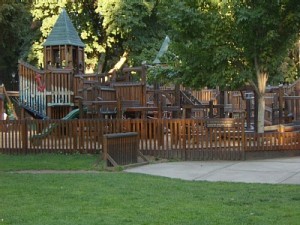
Well shaded and lake-side: Fort Sherman is the perfect playground!

Well shaded and lake-side: Fort Sherman is the perfect playground!

416 Mullan Road
Coeur d’Alene, Idaho

Fort Sherman Playground is the perfect place to stop along mountainous I-90 during a summer vacation. A beautiful city in any season, Coeur d’Alene is a is a summer recreation mecca with ample hiking, swimming, boating, fishing, and golf. Fort Sherman Playground at City Park offers a sprawling, 14,000 square foot wooden ‘fort’ play space on 17 acres near the lake’s edge. Sit in the shade while your kids play on the structure, then take a quick dip in the lake.

If you have more time, the Downtown Waterfront area offers a number of other options such as parasail rides high above the water, jet skis, kayaks, paddleboats and canoes for rent. The main office for rentals is located along the world’s longest floating boardwalk, located at the Coeur d’Alene Resort.

Date last visited: June 2009

Distance off the interstate: Five minutes.

Hours and Admission Prices: Free.

Bathrooms: Nice public bathrooms are located by the play structure.

Food Services: Many restaurants line the lake-front area. A good bet for a sweet snack is The Bakery by the Lake. Kids love all the homemade muffins and scones.

Website: http://parks.cdaid.org/index.php?option=com_content&task=view&id=24&Itemid=56

Directions: From I-90 take NW Boulevard South all the way downtown. Turn right on Mullan Road for parking.

View Larger Map


Spokane’s Riverfront Park with kids

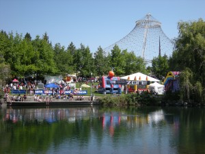
Riverfront Park during one of many summer festivals!

Riverfront Park during one of many summer festivals!

507 N. Howard St
Spokane, WA

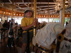
If you find yourself driving I-90 from Seattle or Idaho’s ski and outdoor country, Spokane’s Riverfront Park is a beautifully appointed greenbelt worthy of a stop. Much more than a simple pit stop, the park spans both sides of the Spokane River and includes a pavilion originally built for the 1974 Expo, amusement rides, an ice skating rink, a Sky Ride gondola, an old fashioned carrousel, a giant red wagon slide, and plenty of grassy slopes, mature trees, and ducks to feed.

Riverfront Park with kids:

Try to grab the 'golden ring' on the carrousel!

Try to grab the ‘golden ring’ on the carrousel!

If the weather isn’t cooperating, try the IMAX theater (schedule listed under ‘Hours and Admission Prices below) or Mobius Kids Children’s Museum, located on the lower level within River Park Square, downtown Spokane’s premiere shopping center.

Date last visited: June 2009

Distance off the interstate: Two minutes off I-90.

Hours and Admission Prices: For the hours and admission prices of the various attractions (which change seasonally), click here. Be sure to ask about all admission options: during the summer months especially, day passes and punch cards can offer the best discounts for families.

Bathrooms: The nicest bathrooms are located within River Park Square on the lower level (through the entrance adjacent to the park). Others are located within the pavilion near the Ice Palace (winter) and carnival rides (summer).

Food Services: Food vendors and concessions abound in the summer months; year round, great options for families can be found in River Park Square. My family’s favorite? The Sawtooth Grill (located on the lower level), where TinkerToys and board games line the a shelf awaiting antsy children.

Website: http://www.spokaneriverfrontpark.com

Phone: 1-800-336-PARK

Directions: From I-90, take exit 281 to merge onto S Division St/US-2 E/US-395 N. Turn left at W Spokane Falls Blvd.

NOTE: Vehicles are not permitted in the park. Parking is available in several lots on the north end. The easiest place to park, however, is in the parking garage at River Park Square. Follow the signs from Spokane Falls Blvd!
View Larger Map


Bear Creek Recreation Site

Highway 42
Oregon

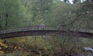
You won’t find a better place to stop along windy Highway 42 on your way to the Oregon coast than the Bear Creek Recreation Site. Located between Roseburg and Coquille off Highway 42, look for the sign on the right-hand side directly after the Bear Creek bridge. There’s parking for several cars, a picnic area, bathrooms, and a beautiful foot bridge over Bear Creek ending in a short trail through the dense forest.

Looking down at Bear Creek from the foot bridge.

Looking down at Bear Creek from the foot bridge.

If the site is crowded, drive a few more miles to Sandy Creek Bridge, one of Oregon’s last standing covered bridges. It will be on the north side of the highway (right), 1/4 mile west of the Remote exit.

Date last visited: November 2009

Distance off the interstate: Directly off Hwy 42. Approximately 30 miles from I-5.

Hours and Admission Prices: None. Camping is permitted at the single site, but for a 24-hour maximum.

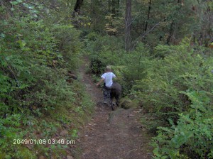
Hiking the trail along with the dog.

Hiking the trail along with the dog.

Bathrooms: Flush toilets and sinks, all quite clean. Open year round.

Food Services: None.

Website: More information can be found at recreation.gov.

Directions: From I-5, travel west (from Roseburg or Winston) on Hwy 42.


High Falls State Park with kids

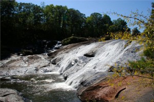
High Falls (photo courtesy of Georgia State Parks)

High Falls (photo courtesy of Georgia State Parks)

76 High Falls Park Dr
Jackson, GA

Mondays are for dreaming, and today, I’m dreaming of being out-of-doors, enjoying autumn sunshine! Late fall can provide some of the best hiking and nature walking, and if you’re living in or driving through Georgia on I-75, High Falls State Park is a beautiful place to stop and explore for an afternoon or an entire weekend!

High Falls State Park with kids:

Hike the 4.5 miles of trails, visit the waterfall on the Towaliga River, and explore the site of a grist mill (in the remains of a ghost town). High Falls also boosts a lake, picnic shelters, boating, and fishing. Canoe rentals are also available.

Throughout the month of November, check Georgia State Parks’ Leaf Watch guide (and for your summer visits, remember that there’s a seasonal swimming pool as well)!

There’s also plenty of tent, trailer, and RV camping, but if you think it’s too cold to camp this last in the season, think again! With beautiful rustic yurts, traditional camping can be extended all year long! (As you may know, I’m a big fan of yurts!)

Distance off the interstate: One mile off I-75

Hours and Admission Prices: Daytime parking fee is $5 per car. If you’re interested in visiting one of Georgia’s other state parks, such as Red Top Mountain, lodge rates have been reduced significantly for the off-season! Find a room here: http://gastateparks.org/core/item/page.aspx?s=171331.0.1.5&mode=h

Food Services: Says Georgia State Parks Public Affairs Coordinator Kim Hatcher, There’s a great Southern restaurant one exit north (Buckner’s) with some of the best fried chicken in Georgia!

Website: http://www.gastateparks.org/info/highfall/

Directions: From I-75, take Exit 198 at High Falls and go 1.8 miles east on High Falls Road.

This pit stop submitted by Kim Hatcher. Thank you, Kim! I’m always happy to promote the beauty of state parks!

Red Top Mountain State Park

Boy holding a pumpkin

50 Lodge Road SE
Cartersville, GA

Autumn is officially upon us here in the northern hemisphere, and I’m very excited to kick off a new series of pit stops centered around fall festivals and events with Red Top Mountain State Park’s Fall at the Homestead! Located just one mile off I-75 on beautiful Lake Allatoona, there’s no better time to visit Red Top Mountain State Park than this weekend (September 26-27). Not only will you have the opportunity to take part in their autumn festival, but you’ll park for free! This Saturday only, all Georgia state parks are waving their parking/vehicle fee.

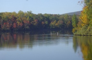
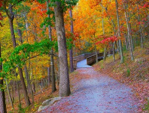
A hiking trail in Red Top Mountain State Park in autumn.

A hiking trail in Red Top Mountain State Park in autumn.

More on Fall at the Homestead (Sept. 26-27):

From the official website of Georgia state parks: Step back to the early 1800s with a visit to Vaughn Cabin to learn about pioneer life. Try your hand at candle dipping and woodworking, or play a few games. On Saturday night, we will fire up a large furnace for the always popular iron pour. Come early to buy scratch blocks to design your own keepsake. We’ll fill it with molten iron, and once it cools late that evening, you can take it home. ($7 scratch blocks for iron pour.)

While you’re visiting, be sure to take advantage of the many hiking trails and the swimming beach Red Top Mountain State Park has to offer!

Distance off the interstate: 1.5 miles from I-75 exit 285.

Hours and Admission Prices: Free parking on Saturday, September 26th. $5 parking on Sunday.

Bathrooms: Yes.

Food Services: Many picnic shelters are located along the lake shore as well as a restaurant located within the lodge. The Mountain Cove Restaurant is open year-round and serves buffet and a la carte meals for breakfast, lunch and dinner.

Website: www.GaStateParks.org/redtopmountain

Directions: From Atlanta, take GA-401 N/I-75 N for 37 miles, then take Exit 285 for Red Top Mountain Road. Follow for .3 mile, the keep right at the fork to merge onto Red Top Mountain Rd SE.

Thank you to Kim Hatcher, Public Affairs Coordinator of Georgia State Parks & Historic Sites for providing the information on this event! 
View Larger Map