Reed Bingham State Park

542 Reed Bingham Road
Adel , GA

Not quite ready to let go of summer? Reed Bingham State Park “is about three and a half hours from Atlanta…if camping isn’t your thing, it’s also a good place to just get off the road for a bit to stretch your legs, enjoy a picnic or even squeeze in a game of mini-golf. In addition to mini-golf, Reed Bingham has a nice playground, beach and boat docks. They also rent bicycles and canoes and offer pontoon boat tours. It’s an excellent place for bird watching or learning more about the resident gopher tortoises. The park staff rehabilitates various animals that are orphaned or left on the property. We were lucky enough to see a hummingbird, bluebird, red-headed woodpecker and even a bobcat kitten!”

Review courtesy of Sue from Field Trips with Sue.

Date last visited: August 2009

Distance off the interstate: Less than 6 miles off I-75.

Hours and Admission Prices: $5 park entrance fee per car (camping fees start at $23)

Website: Reed Bingham State Park

Directions: 6 miles west of Adel on Ga. Hwy. 37 via I-75 exit #39, and 14 miles east of Moultrie from U.S. Hwy. 319.

Alfred B. Maclay Gardens State Park

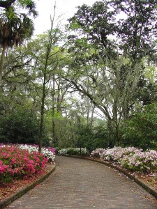
Brick path leading to the Maclay house. Photo courtesy of Florida State Parks.

Brick path leading to the Maclay house. Photo courtesy of Florida State Parks.

3540 Thomasville Rd
Tallahassee, FL

Alfred B. Maclay Gardens State Park is a wonderful place to get out and stretch your legs during a long trip. During blooming season, flowers paint the walk with beautiful colors and during the off season you can see every shade of green, says Jennifer of Two Kids and a Map, who brings us this review. I was on a road trip from Pensacola to Jacksonville, Florida with my two children by myself and we desperately needed a pit stop! The kids were getting hungry and anxious and I was tired of listening to the whining. Unfortunately, the exit I chose is awful for quick interstate stops. There are several lanes of traffic and it is difficult to turn around to get back on the Interstate. I spotted the trademark Florida State Park sign and followed it to the entrance. It was a perfect stopping place for us. The children got to run along the path of the gardens and burn off some steam. There was so much to look at: a hidden garden, a lake and a pond, and the beautiful home. The kids enjoyed looking for bugs and eating a picnic lunch on the grounds before we got back on the road.

Date last visited: July, 2009

Distance off the interstate: Approximately 1 half mile off of Interstate 10.

Hours and Admission Prices: $6.00 per vehicle to enter the park. During the blooming months, it is an additional $6.00 an adult and $3.00 a child to enter the gardens. However, during the off season (May through December) touring the gardens is free.

Bathrooms and Food Services: Bathrooms are available and there are picnic areas if you bring your own meal

Other tips: Be sure to get your Real Florida Passport stamped while you are there. You can walk down to the house and back in about 30 minutes if you do not stop too many times!

Website: http://www.floridastateparks.org/MACLAYGARDENS/

Directions: Located one half mile north of I-10 on U.S. 319
View Larger Map

McArthur Burney Falls State Park

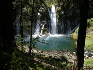
The inviting pool at the base of the falls.

The inviting pool at the base of the falls.

24898 Hwy 89
Burney, CA

McArthur Burney Falls State Park is one of the nicest state parks I’ve run across in a long time. In northern California’s volcanic country near Lassen National Park, it sits directly on Highway 89 near Burney. After you enter the park, you’ll find a large, shaded picnic area to your right, with parking to the left. Follow the signs to the Burney Falls overlook for an amazing view. 129-feet high, Burney Falls is stunning (and dumps 100 million gallons of water a day!). The 0.3 mile walk to the base of the falls is well worth it; at the bottom, enjoy the soft spray or dip your toes in the freezing water. The basin is a beautiful blue. There’s a loop trail to try if time is permitting (1.3 miles), or just retrace your steps back to the top (0.6 round trip). We picnicked at a nearby table, but wished we’d had enough time for a swim in nearby Lake Britton.

Date last visited: July 2009

Distance off the interstate: Located directly on Highway 89, or six miles north of Highway 299.

Admission Prices: $6 per car for day use.

Bathrooms: Located across the street from the day use parking. They looked brand new.

Food Services: A nice general store with all the necessities, plus soft serve ice cream!

Website: http://www.parks.ca.gov/?page_id=455

Directions: Take Highway 89 near Burney. (From Redding, go north on Hwy 299 past Burney and follow signs.)

View Larger Map

Slide Rock State Park

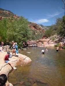
Slide Rock State Park, July 2009

Slide Rock State Park, July 2009

6871 N. Highway 89A
Sedona, Arizona

Slide Rock State Park may be a bit further off the beaten path than most pitstops (18 miles from Flagstaff), but it’s a mere five miles from the popular vacation town of Sedona, and well worth any amount of effort.

Slide Rock State Park planning:

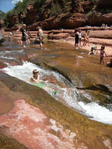
Located down Highway 89A along a particularly scenic stretch of Oak Canyon, Slide Rock State Park is exactly what it professes to be: a slippery, natural waterslide. Upon first sight, my kids were awestruck, and quite frankly, so was I. At least a quarter mile of the river is cut so perfectly out of the red rock canyon, it appears man-made. The water pools and eddies around smoothly rounded slabs of granite, creating both slick slides and deep diving holes.

Nate, sliding down a shute.

Nate, sliding down a shute.

There’s about a quarter mile walk from the parking lot to the swimming site. It’s easy to access, but bring good water shoes. I know this is simply common sense, but the rocks are very, very slippery. We fell many times, and saw worse. There’s very little shade, and not much room on the slabs of stone for chairs. We opted to bring only beach towels and a cooler with cold water, which worked out great. We didn’t spend much time out of the water, anyway!

Date last visited: July 2009

Distance off the interstate: 18 miles off I-17 on Hwy 89A from Flagstaff; five miles from Sedona.

Hours and Admission Prices: Slide Rock is a state park, and entry is $10 per car or $2 per person. Hours are sunrise to sunset, but be advised: the park becomes very crowded on hot summer days, and when the parking lot fills, the park is closed. We visited on a Tuesday in July, and were one of the last cars admitted at 11 am. Get there early!

Bathrooms: Near the parking lot.

Food Services: There is a small general store located near a historic homestead en route to the slide (after the parking lot). It was well-stocked with cold drinks, ice cream, and snacks, but don’t plan to get a full lunch here.

Website: http://azstateparks.com/Parks/SLRO/

Directions: From Sedona: Head north on AZ-179 toward Sombart Ln. Turn left to stay on AZ-179, then turn right at N Hwy-89A/AZ-89A.

From Flagstaff: Take AZ-89 toward Sedona. Turn left at S Hwy-89A/AZ-89A. Turn left at N Hwy-89A/AZ-89A.


View Larger Map

E.J. Roberts Park

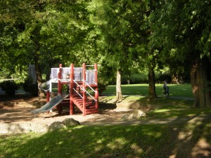
Shady and green playground in E.J. Roberts Park

Shady and green playground in E.J. Roberts Park

North Bend
Washington

If you’re stopping for a quick bite to eat in North Bend, WA, you’ll quickly lament the lack of play lands at any of the fast food offerings. But a quick inquiry of the drive thru staff at Taco Time led us to E.J. Roberts Park. Only a few minutes into town (and it’s a lovely town!), EJ Roberts is a beautiful little respite from a long roadtrip. Located in a quiet residential area, the park is medium-sized, with a shaded play area, lots of grass to throw a ball around, and picnic tables, all with a stunning mountain backdrop.

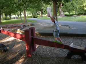
Toby, engage in horseplay? Noooo....

Toby, engage in horseplay? Noooo….

Date last visited: June 2009

Distance off the interstate: Three minutes off I-90.

Bathrooms: They were not very clean, but frankly, we were just glad they were there!

Food Services: Plenty of fast food nearby, including McDonald’s, Taco Time, and KFC. There’s also a Safeway within five minutes.

Directions: From I-90, take Bendigo Blvd to E. 4th, then turn left on Ballarat. Turn right on SE 114th, which turns into 6th. Park is on the right.

For more travel photos today, check out Photo Friday at delicousbaby.com.
View Larger Map

Lithia Park

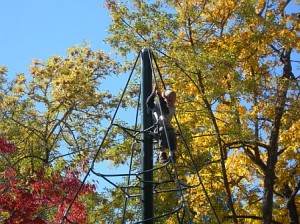
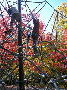
Lithia Park Ashland, Oregon is a stunningly beautiful 93-acre park in a garden setting situated within easy distance of 1-5 for either a quick pitstop or an afternoon detour. Located on the north end of Ashland, Oregon in their pedestrian-friendly downtown, there are several entrances to this sprawling park, but the easiest to access from the city center is on Winburn Way. Park either in the city square or follow Winburn around the side of the park, and cross one of the several arched bridges over Ashland Creek. At this north end of Lithia Park, you’ll find a duck pond and excellent play structure, complete with climbing wall/rock and rope tower. Near the play area is easy access to the creek, where kids can dip toes on hot days (unless signs dictate otherwise¦the creek is closed to waders during some summers).

Almost at the top!

Almost at the top!

If you have time, continue on the marked paths to the south end, where you’ll find tennis courts, a second (more inhabited) duck pond, and hiking trails.

On the way back to the car, let the kids peek into Small Change, an excellent toy and boutique-quality children’s clothing store at 5 N. Main. Little ones can climb up the ladder into an elevated loft (fully enclosed with a latching gate) where they are encouraged to play with a selection of toys while you peruse the offerings. The other shops along the square are fascinating to poke around in as well, if your kids have the patience!

Nate and Cal climbing the rope tower.

Nate and Cal climbing the rope tower.

Date last visited: June 2009

Distance off the interstate: About five minutes’ drive.

Bathrooms: Clean bathrooms are located by the play structure. Many shops and restaurants are also within walking distance.

Food Services: Downtown Ashland has a plethora of excellent restaurants, but our personal favorite with kids is Munchies, located right in the heart of the square, on the corner of N. Main. They serve great vegetarian fare as well as burgers, pasta, and Mexican selections. There are also several ice cream and candy shops along the same block, as well as Big Town Hero and vegetarian and Thai cuisine.

Directions: From I-5, take exit 19 and turn right at S Valley View Rd. Turn left at Hwy-99 and continue 2 miles. Take a slight right at Guanajuato Way, then turn right at Winburn Way.

View Larger Map


Multnomah Falls

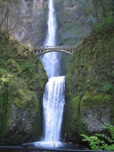
450px-multnomah_falls_from_the_baseMultnomah Falls
Oregon

It’s hard to miss Multnomah Falls when traveling I-84, but you really need to stop and see it up close to appreciate its 620 foot height. And this pitstop doesn’t have to take a lot of time. From the parking lot, walk under the road through the pedestrian tunnel to the lodge and base of the falls (amazingly, even with a spectacular waterfall yards away, my kids were still more enticed by the tiny creek that runs the length of the parking lot¦go figure!). You can view the falls right from here, but to get the kids some much needed exercise, I’d suggest taking the fairly easy, short hiking trail up to Benson Bridge (midway up the falls). If you have even more time and energy, the trail to the top of the waterfall is worth the effort, but keep in mind that it’s steep (with switchbacks) and over a mile long. A historical center resides inside the lodge, by the gift shop (yes, of course there’s a gift shop! It’s a nice one, though!). …read more»

Bear Creek Park

A section of the Bear Creek Greenway

A section of the Bear Creek Greenway

1520 Siskiyou Blvd
Medford, OR

Bear Creek Park is an excellent pitstop that quite frankly, I forgot to review earlier because it’s right in my hometown. It’s also, however, right off of I-5 but tucked out of sight, making it a perfect candidate for Pitstops for Kids. Bear Creek Park is huge, and has something for everybody. On the east end of the park are a dirt BMX track (try it out if you have bikes with you!) and a large skate park. Parking is available there, or on the opposite end, by the large fortress’ playground. This is the most shaded area, with a huge climbing structure, tire swings, slides, and more. Bike paths connect this playground with the skate park (and tennis courts in-between). Also connected to the park is the Bear Creek Greenway bike path, which runs miles in either direction (toward Ashland, Oregon and Central Point, Oregon). If you have time, the greenway is a shady place to be on a summer day.

…read more»

Columbia Park

559fb87b-cdd6-4d12-912d-c3820bff5253

 Highway 240, W. Columbia Drive
Kennewick, WA

Columbia Park is located in Washington’s Tri-Cities, just off Highway 395 (from I-84 from Portland, OR or I-90 form Spokane). It’s a great place to stop to stretch legs and have a quick picnic. Situated along the Columbia River, the park is over five miles long, but the section you want is at the west end where a large fort-style climbing structure awaits.

The park is free, and there are half a dozen fast food restaurants nearby if you need to grab something to go. Dig swimsuits out of the car, because a great splash park, with fountains, squirt nozzles, and cascading buckets of water is adjacent to the play structure. Picnic tables under shade canopies are available, but fill up fast in the summer. The park is year round, although the splash park shuts off for the winter months.

The only downside: Unless you’re route is taking you northwest on 240, you do have to go several miles out of your way in that direction to get back onto 395 East or West to resume your trip.

…read more»