Summer in the Sierras: Plumas County CA with kids

For the Pit Stops for Kids family, writing about summer vacations in the Sierra Nevada mountain range, and in particular, Plumas and Sierra counties in California, is quite literally like writing about home. My husband and I both grew up in this alpine area, and love sharing it with other traveling families.
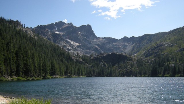
Plumas County is located one hour west of Reno, Nevada and 2.5 hours north of Sacramento, California. Past the foothills of the Gold Country, this summer playground offers alpine recreation in the form of hiking, lake and river swimming, fishing, golfing, and wildlife viewing. If you’re looking for expensive resorts and polished kids’ programs, look elsewhere. Plumas County is steeped in true wilderness: you’ll find rustic lodges, comfortable inns, ample camping, and gorgeous scenery (but the first Starbucks and the first stop light just went in the past few years).

We suggest families make Graeagle, California their home base, as this tiny town east of Quincy on Highway 89 is centrally located to the best hiking, fishing, and golfing. (Plus, it has a frostee freeze to die for on a hot summer day.) From there, explore the network of hiking trails and lakes in the Lakes Basin Recreation Area, go antiquing or hit award-winning links, schedule a horseback ride, or just float lazily in the town’s popular Mill Pond on an inflatable raft. Whatever you do, don’t plan to leave for at least a week!

Where to stay: This depends on the type of vacation you’re looking for. If you’re camping, expect only bare bones amenities (pit toilets and communal running water are the standard), a drawback that’s more than made up for by the total immersion in your wilderness surroundings. Our favorite campground is Lakes Basin, a short drive from Graeagle up Gold Lake Highway. If you’re looking for a motel, the River Pines Resort offers both motel rooms and weekly home rentals.
What to do: Where to start?!

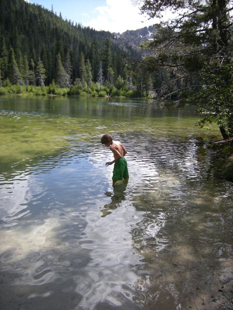
Hiking and lakes: Families will love exploring all the beautiful alpine lakes this region offers. The gateway to our favorite lakes (connected by a network of hiking trails) starts from Lakes Basin Campground at the Lakes Basin Recreational Area (seven miles up Gold Lake Highway from Graeagle, follow signs). From there you’ll find trails ranging from easy to moderate to a variety of great swimming lakes. Pack a lunch and towels in a backpack and make an afternoon of it!

For lakes accessed by car, consider Sand Pond (five additional miles up Gold Lake Road near the intersection of Highway 40), where the shallow depths and sandy bottom are perfect for younger kids. A few miles away via surface road (follow signs from Gold Lake Road) lies Packer Lake, which boasts picnic sites, a swimming platform, and a lodge from which families can order lunch to go. (Order their milk shakes!)

Right in town, you’ll find the Mill Pond, a local swimming favorite surrounded by grass, quaint shops, and a snow-cone hut. Bring your inflatables and sunscreen!

Local history:

Twenty minutes away from Graeagle by car lies the historical gold mining town of Johnsville, CA (up the Graeagle/Johnsville Road). Tour the stamp mill and a period home at Plumas Eureka State Park, then learn about the area’s mining past at the museum.

If you have kids interested in trains, drive ten minutes from Graeagle up Highway 70 to Portola, where you’ll find the

Family fun: Graeagle is known for its golfing and fishing. Anyone in town can point you in the direction of the best courses, and the same goes for fishing holes. Our favorite places to drop a line with kids are the Feather River (near Portola) and the Yuba River (near Bassett’s Station on Highway 49).

Where to eat: For family fare, Gumba’s Pizza in nearby Blairsden CA can’t be beat. In summer, sit on the deck while the kids play air hockey in the game room. The Graeagle Frostee is also a hot spot in summer (plan for a line during the lunch rush), and a fun miniature golf course is located right next door. For a nice night out, try the dining room at Graeagle Lodge (20 minutes up Gold Lake Road).

Find more information on area lodges and campgrounds!

Bear Lake State Park Rendezvous Beach

Clear, turquoise-blue water. White sand beaches. Scuba diving, fishing, and wind surfing. Would you guess you’re in Utah? I wouldn’t! In fact, until I saw Bear Lake’s Rendezvous Beach for myself, I assumed the state park was exaggerating with its claim to be the ‘Caribbean of the Rockies’. But it’s no lie: right on the Utah-Idaho border near the touristy town of Garden City, weekend visitors (and weary travelers) will find a veritable paradise laid before them.

Bear Lake with kids

Rendezvous Beach is located at the south end of the lake near the aptly named town of Laketown. There you’ll find plenty of beach space, picnic areas, boat ramps, and facilities such as bathrooms and showers. Before reaching Laketown on Highway 30, however, other lake access is available, and visitors can be found parking along the side of the highway and enjoying day use along the shore from Garden City. We joined them, hoping to avoid the largest congestion. I’m not sure we succeeded: it was a busy summer day, and the beaches were crowded throughout the lake, but we enjoyed our location. With plenty of white sand, a wide eddy of water for young kids to play in, and shallow water well into the lake, it was a very safe and fun space for families. Note: bring an umbrella or other shelter; the one thing Bear Lake lacks is much natural shade!

We stopped at Bear Lake only long enough to take a swim and enjoy a picnic, but if you have more time to spend, many outdoor recreation opportunities abound. Rent water sport equipment, hire a fishing guide, or learn about area hikes.

Distance from the interstate: On Utah Hwy 30, right off well-traveled Highway 89. (Bear in mind that in the summer months, traffic can back up at Garden City, making for a slow final few miles to the beaches.)

Date last visited: July 2010

Admission fee: To visit Rendezvous Beach proper, you’ll be entering state park property, and an $8 per car admission will be enforced for day use. Other beach access along Highway 30 is free. (The $8 may be money well-spent for the use of facilities, however; there were no bathrooms along the shore elsewhere.

Hours: 8 am until 10 pm year-round.

Food services: Garden City offers plenty in the way of fast food, grocery stores, and small cafes and food stands. We suggest packing a picnic or BBQing on the beach!

Website:http://www.utah.com/stateparks/bear_lake.html

Directions: From I-15, take Highway 30 (89) south to Garden City. From

McArthur Burney Falls State Park

The inviting pool at the base of the falls.

The inviting pool at the base of the falls.

24898 Hwy 89
Burney, CA

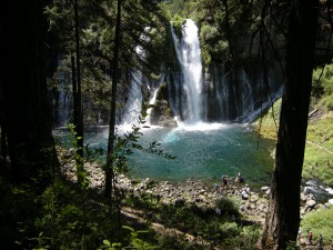
McArthur Burney Falls State Park is one of the nicest state parks I’ve run across in a long time. In northern California’s volcanic country near Lassen National Park, it sits directly on Highway 89 near Burney. After you enter the park, you’ll find a large, shaded picnic area to your right, with parking to the left. Follow the signs to the Burney Falls overlook for an amazing view. 129-feet high, Burney Falls is stunning (and dumps 100 million gallons of water a day!). The 0.3 mile walk to the base of the falls is well worth it; at the bottom, enjoy the soft spray or dip your toes in the freezing water. The basin is a beautiful blue. There’s a loop trail to try if time is permitting (1.3 miles), or just retrace your steps back to the top (0.6 round trip). We picnicked at a nearby table, but wished we’d had enough time for a swim in nearby Lake Britton.

Date last visited: July 2009

Distance off the interstate: Located directly on Highway 89, or six miles north of Highway 299.

Admission Prices: $6 per car for day use.

Bathrooms: Located across the street from the day use parking. They looked brand new.

Food Services: A nice general store with all the necessities, plus soft serve ice cream!

Website: http://www.parks.ca.gov/?page_id=455

Directions: Take Highway 89 near Burney. (From Redding, go north on Hwy 299 past Burney and follow signs.)

View Larger Map