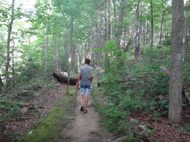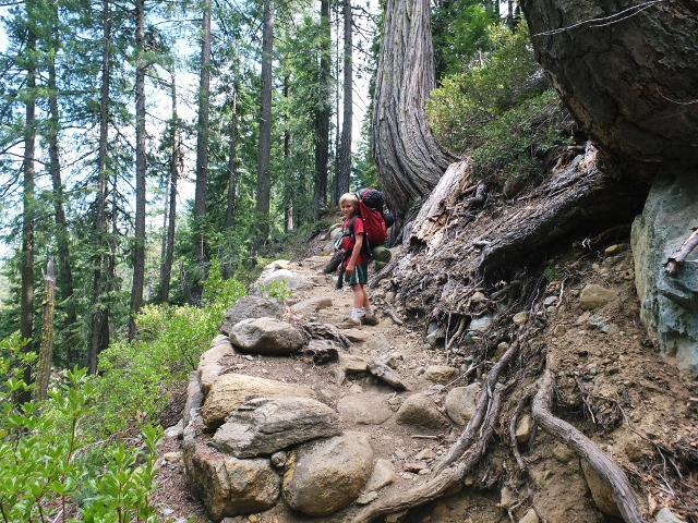


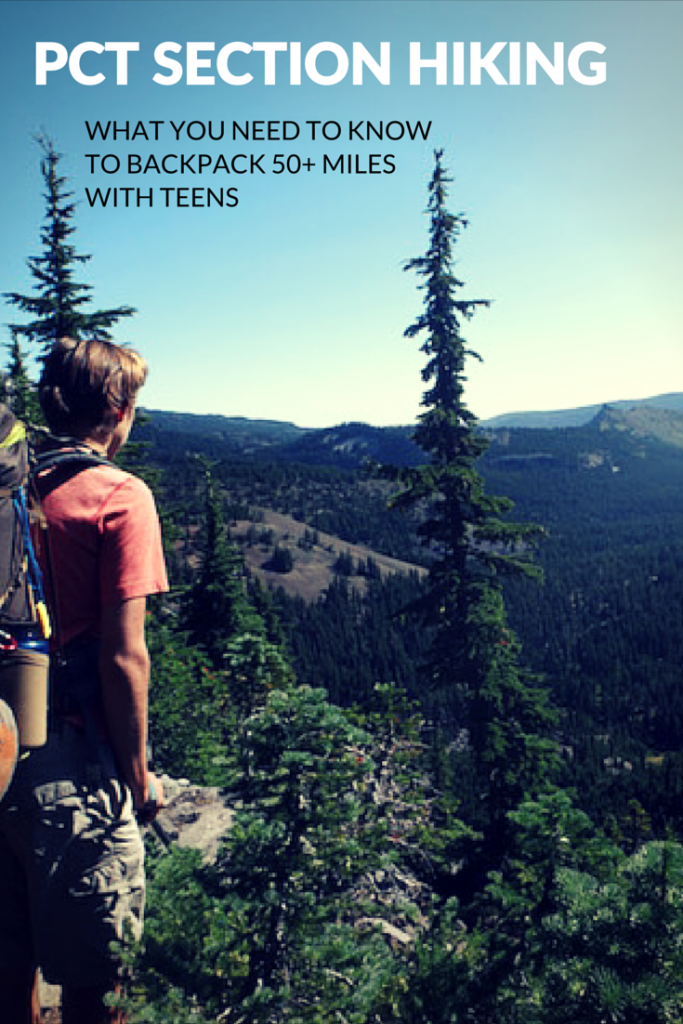
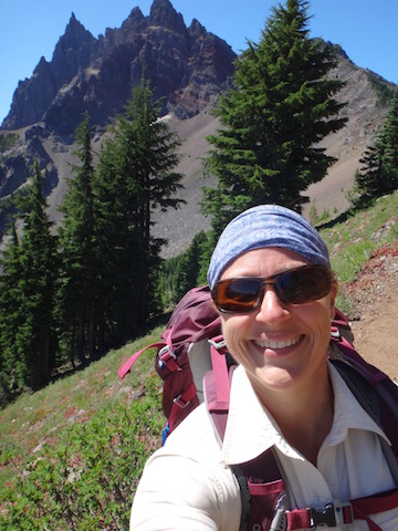
We’ve been wanting to backpack on the Pacific Crest Trail (PCT) long before it was cool. This summer, my 16-year-old and I finally set out, tackling almost 70 miles of the PCT in Central Oregon. We built up to this trip with years of family backpacking, including several 3-4 night trips, starting when my son was just a toddler. How did we fare? We had one of our best backpacking trips ever!
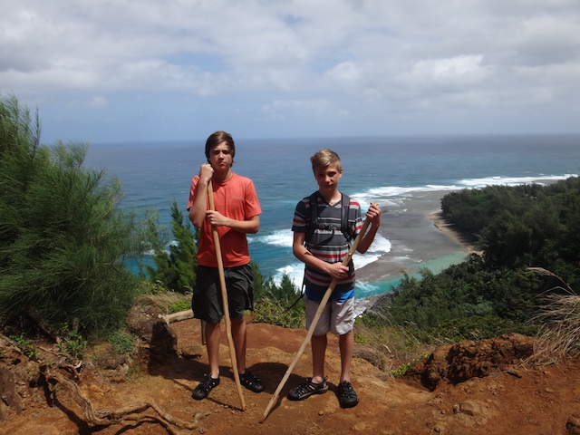
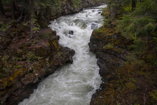
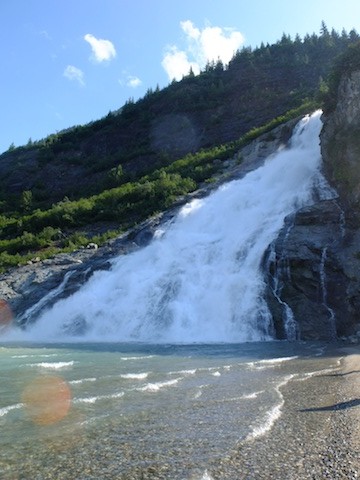
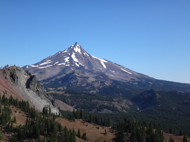
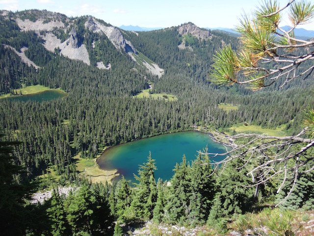
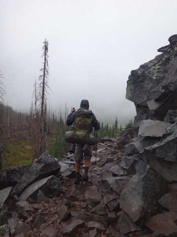
Our PCT section hike spanned over 65 miles from Central Oregon’s Mckenzie Pass by Sisters to Olallie Lake, outside Detroit, Oregon. It took us through the Jefferson National Forest and Jefferson Park, past the three Sisters peaks, Broken Top, Three Fingered Jack, Mount Washington, and Mount Jefferson. Every day brought new scenery, from forests depleted by fire to mountain meadows still filled with wildflowers, to rushing creek crossings, to mountain ridge lines, saddles, and peaks.
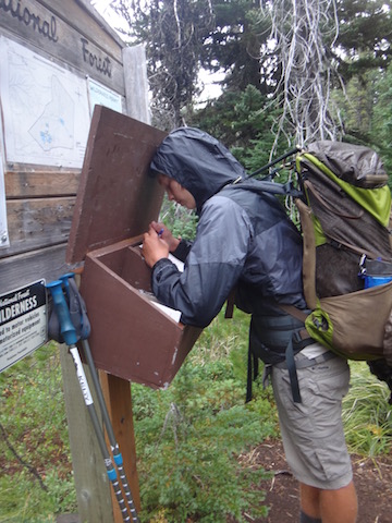
My son and I felt a keen sense of accomplishment as we navigated landmarks along the trail with our PCT data book and topographical maps, found our own water resupplies, made and broke down camp every night and morning, carried everything we needed on our backs, and relied entirely upon each other for basic survival. This trip was a chance for my son to shine as a young man, for me to let go a bit as a mom, and for both of us to bond. We met amazing people on the PCT, both fellow section hikers like us and thru-hikers going to Canada. The community spirit was uplifting, the scenery breathtaking, and the uninterrupted time in the wilderness invigorating.
A day in the life of a PCT section hiking with teens:
Each section hike will look different, depending on where you start and end, of course, but a typical day on the PCT for us looked something like this:
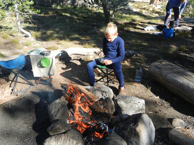
7 am: Wake up. Stumble out of sleeping bags on stiff legs, retrieve the food bag (hung in the night to discourage critters from nibbling), and start boiling water for coffee and oatmeal (assuming we had enough water to spare for a hot meal).
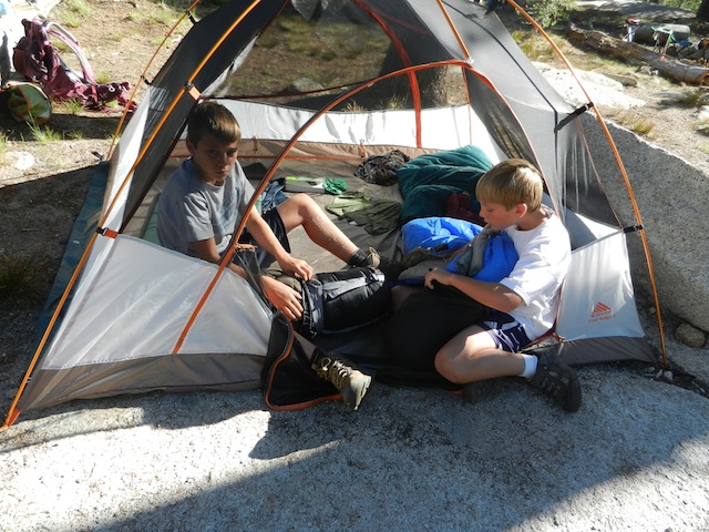
8 am: Change into hiking clothes (our only hiking clothes), doctor any blisters on our feet, and tear down camp. This involves washing any dishes (we quickly learned to have as few as possible), putting away our stove and cooking pot, stuffing our sleeping bags and pads, taking down our little tent, and filling our water bottles for the day.
8:30 am: Hit the trail. Depending on the day, we hiked between 10-15 miles. Some days, we took a break mid-morning at a water source to cook a meal if we hadn’t had enough water to do so earlier, other days we hiked straight until lunch. When is lunch? When we were hungry. Regular rules about meals and routine don’t matter on the PCT: our bodies very quickly adjusted to a natural rhythm of eating when we were hungry and sleeping when we were tired.
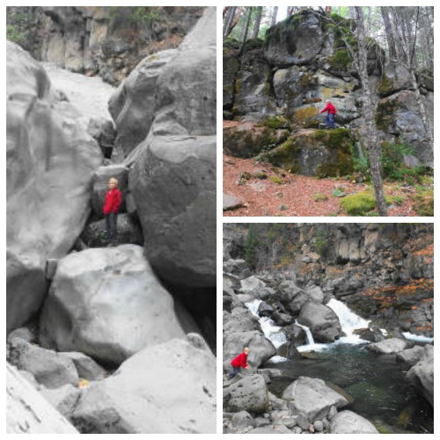
Mid-day stop at a vista, lake, stream, or otherwise interesting landmark: Some days, we’d go for a swim in a lake if one crossed our path, other days we washed our clothes in a creek or sat on the saddle of a ridge, taking in the view.
Late-day stop: We’d always stop at least once or twice per day to filter more drinking water as the opportunity arose. We had to keep a steady eye on our drinking supply and the water sources listed in our data book. Every day, we ran into others on the trail, and we always stopped to talk a bit. We met wonderful people, all on the PCT for essentially the same reasons as us: to commune with nature, to challenge themselves, and to live deliberately and peacefully.
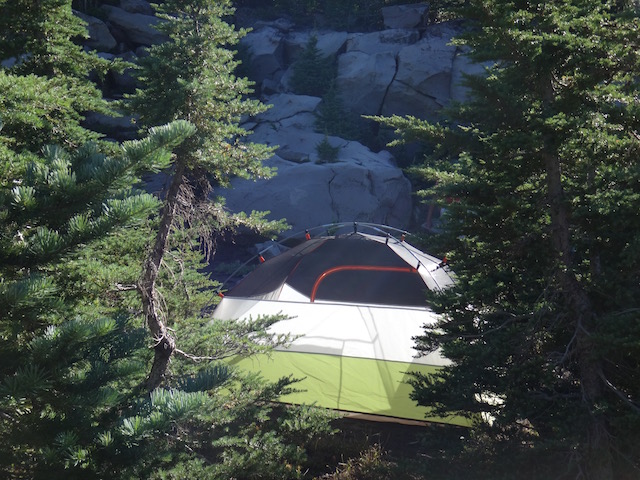
5-6 pm: Arrive at the night’s camp. Where was camp? Wherever we could find one. We always had an ‘ending mile’ planned (aka, mile 14 of the day, for instance) that was near some landmark desirable for camping, such as a lake or stream. However, campsites didn’t always appear on cue. We sometimes stopped shy of our goal, but more often hiked further, in order to come to a good campsite.
7 pm: Set up camp, make dinner (usually mashed potatoes or noodles, as we always craved carbs), and filter water, unless at a dry camp. If we had wet clothes we’d washed in a lake or stream, we hung them to dry.
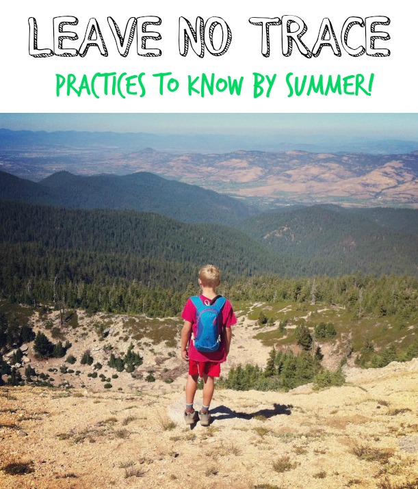
8 pm: Do any dishes (remembering to follow Leave No Trace practices), string up the food bag, make sure all our supplies are tucked away in our bags, get in our sleeping bags. Once in our sleeping bags, we’d study our topographical map to get a preview of the next day’s hike, then read our books until we fell asleep (usually as the sun went down around 9 pm).
How to plan:
Readers of Pit Stops for Kids may remember we started planning our PCT section hike months ago, using information gleaned from PCTA.org. Click on our post, ‘How to plan a multi-night PCT hike with kids’ for details on how we chose when and where to hike.
Since that post, our section hike plan changed a few times. We lost some participants, making the trip a mother-son endeavor, and gained support via car in the form of a trailhead drop-off on Day 1, a check-in and resupply late Day 2, and a pick-up on Day 6.
Once we knew where we wanted our hike to start and end, and how many days we had to accomplish our goal, it was a simple task to break down the trip in miles per day. We then cross-referenced this information with the possible ‘drops’ along the trail (places we could be met by others who could give us aid), and determined to have just one drop during our 6 days out. To do all this, we used the Pacific Crest Trail Data Book and the topographical map dedicated to Central Oregon’s section of the PCT (available at outdoor stores or online).
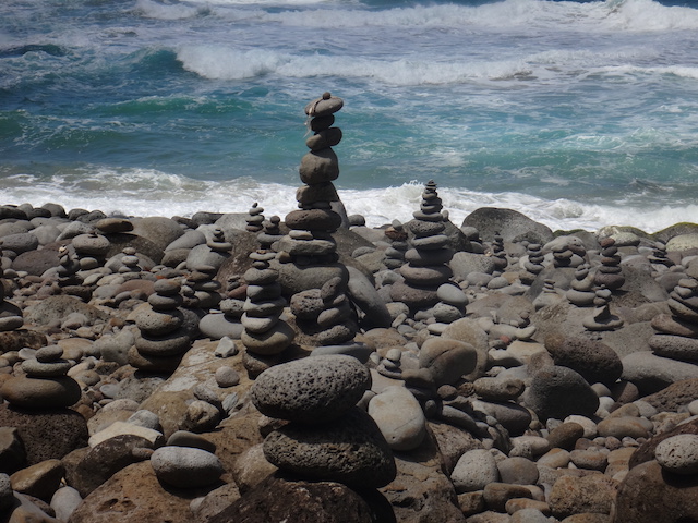
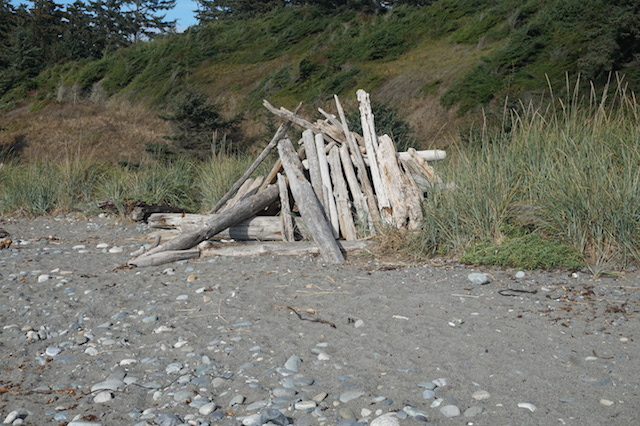
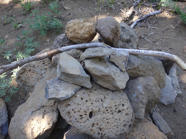
The data book will tell you where along the trail water will be available (in the form of a creek, stream, pond, or lake), but does not tell you where to find campsites (though some GPS programs do). In many sections of the PCT, hikers are permitted to camp anywhere they find an established campsite. You can tell an established site because the ground will be packed down and there may be a small spur trail leading to it from the PCT. Often, other hikers will mark good campsites with cairns (piles or rock), handmade signs using sticks for arrows on the dirt, or trail marking tape.
How to pack:
When we backpack for a weekend or up to three days, we like a few luxuries in our packs, such as hammocks, camp chairs, and java presses. I know, I know. But when we section hiked the PCT, we went bare bones, in order to be as lightweight as possible. Here was what was in our packs (and nothing else), for a total of about 25 pounds per pack:
Clothing:
- 1 set of hiking clothing (quick dry pants, t-shirt)
- 3 pairs wool hiking socks
- 2 pairs underwear
- 1 set of base layers (long underwear, preferably wool)
- 1 down or down-alternative jacket (lightweight, easily stuff-able)
- 1 rain jacket
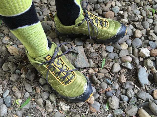
- 1 pair of lightweight sandals
- 1 pair hiking boots
- sunglasses
- sun hat
- thin gloves
Equipment (divided between two people):
- backpacking pack that fits your body: I use Osprey Aura. Teen uses Granite Gear Leopard.
- 1 2-person lightweight tent: we use the Kelty Trail Ridge 2
- sleeping pad: we like the tiny size and comfort of Sea to Summit Comfort Plus
- sleeping bag: Kelty Trail Logic (packs down so small!) and Eureka Dual Temp
- 1 cooking pot: GSI Dualist (we took out some bowls to minimize)
- 1 small bowl (see above, though I did also bring my Sea to Summit collapsible bowl)
- 1 spork
- 1 mug (optional)
- water filter/pump: I love the ease of a gravity-based system. We use Platypus GravityWorks.
- rag for dishwashing
- water bottle or hydration pack: I like my Osprey hydration bladder.
- 1 extra small water container (I use a collapsible Platypus bladder)
- 1 headlamp (plus extra batteries): Snow Peak is my absolute favorite.
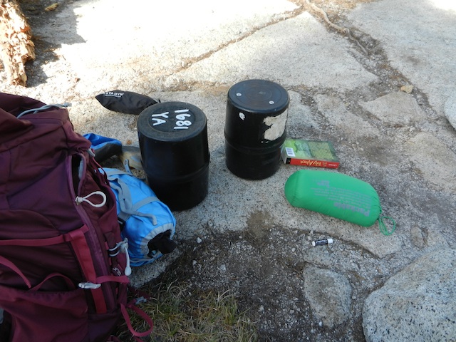
- 3 fuel canisters
- 1 backpacking stove: Snow Peak Gigapower
- pair of trekking poles: Kelty Upslope…we rented these from GetOutfitted, then bought them.
- map and data book (only pages needed)
- 1 paperback to read at night
- first aid kit (small): Adventure Medical Kits has a nice small one.
- toothpaste and toothbrush
- bandana
- bear spray canister (optional)
- lightweight backpacking shovel and TP
- lightweight rope (to hang food at night, except in areas bear canisters are required)
Food (again, divided between us):
We have a tendency to over-pack food, and we managed to do this again, even though we meticulously planned our meals. We have much smaller appetites than we antic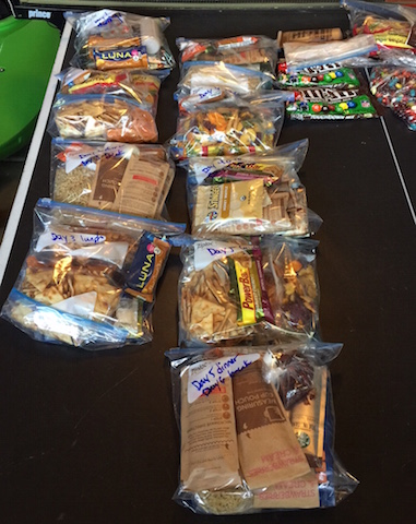 ipated, given how much we worked on the trail. We could barely manage to eat about 300 calories each during the evening meal, and we calculated double this amount. Whoops.
Breakfasts:
- instant oatmeal packets (mix the hot water right into the paper sleeves if they’re the lined kind)
- instant coffee (for us, only Starbucks VIA will do)
- handful of dried fruit
Lunches:
- protein bar of your choice
- dried fruit
- veggie chips or pita chips
- tube of peanut butter to spread on chips
- envelope of tuna
- beef jerky
- snickers bar or M&Ms to snack on
Dinners (one of the following):
- instant mashed potatoes (we like Idahoan)
- Top Ramen
- dehydrated backpacking meal
- mac and cheese
- instant soup
- envelope of smoked salmon or jerky to add to the carb-heavy meals
We essentially rotated these basic foods over and over. And yes, we got tired of them.
Tips we learned on the trail:
Look for trail signs: while many places along the PCT are not officially marked with mileage and other helpful tidbits, other hikers have often left signs to follow. Look for cairns that will direct you to the correct trail, or hand-scratched ‘pct’ letters in logs or even rocks. During one lucky moment, someone just ahead of us on the trail had made an arrow of sticks to indicate a hidden spur trail to an excellent camping site. When we met her later, we thanked her! Another time, we were almost out of water when we ran across a stick with these words in Magic Marker: “Washington Pond: 1/4 mile, muddy but if desperate?!” We were!
Stop to talk with other hikers. They’re awesome, down to a person.
Let your kids have responsibilities. During our hike, my son was pretty much an equal with me, making important decisions and partnering in all the tasks and work. We both loved this. He’s preparing for bigger and longer hikes in his future, and I will know he’s prepared.
Stop to rest when it feels right. A few times on the trail, we pushed ourselves for no reason other than to ‘make good time’. When the only task of the day is to hike to the day’s destination, don’t be afraid to spend the whole day doing it.
Eat when you’re hungry. Once, we stopped at a creek mid-hike and decided to get out the stove and make a big bowl of chowder at 3 pm. It was supposed to be our dinner, but we wanted it then. We didn’t regret it.
Don’t duplicate equipment. It seems silly now, but we brought two stoves (very small and lightweight) and two pots (not so lightweight). We thought we might want to convenience of boiling two pots of water simultaneously (to have coffee and oatmeal at the same time, for example). We ended up preferring to have patience rather than carry the extra weight.
Issues to be prepared for:
When hiking most of the day, every day (regardless of mileage), certain physical issues may occur. It’s not fun to talk about, but…
 Chaffing: Skin rubbing against skin for hours at a time can cause major discomfort in sensitive areas. The solution: antibiotic ointment or Vasoline applied before hiking. It can also help to change underwear.
Diarrhea: Lots of water, plus lots of physical exertion, plus exposure to the elements and different food than usual can wreak havoc on the digestive system. Give it a day or two before worrying, making sure you continue to hydrate. Of course, make sure to filter or boil all water.
Bad moments: There will be low moments. Maybe the incline in the trail will seem endless, or a wind and hailstorm will beat down. Maybe you’ll be thirsty or hungry or your feet will be in agony. It’s good for kids (and adults) to remember that pain, discouragement, and suffering can be temporary, and that they can get through these times. Truly.
Blisters: AKA, the bane of my existence on the trail. I always get blisters, no matter what preventative measures I take. Bring lots of moleskin and athletic tape, use skin-tac to make your skin around the blister tacky before applying moleskin or bandages, and make sure your shoes fit properly. If you have tips for avoiding or fixing blisters on the trail, please let me know.
Dehydration: Ask your hiking partner when he or she peed last. Trust me, it’s an acceptable question on the trail.
Was it all worth it? Absolutely. Would we do it again? We definitely will, in-between more 2-3 day backpacking trips with all the kids.