Guide to Iceland national parks

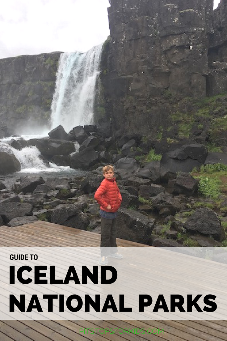
Nearly ALL of Iceland looks like a national park, so families can’t go wrong finding beautiful outdoor experiences on an Iceland vacation with kids. But Iceland national parks do pack in a lot of interesting natural features you won’t want to miss. Here’s what to see in each.

guide to Iceland national parks

Þingvellir National Park:

Þingvellir is easily accessed from Reykjavik, and is located on the Golden Circle, so expect to share space with plenty of tour buses. However, it’s absolutely worth the trip. Start with the main attractions: the rich Viking history in various sites and the location where you can see the shifting of the tectonic plates (over the course of millions of years). There are several walking paths here (we wouldn’t quite call them hikes), the largest of which will take you up to a viewpoint (which is where they put the visitor center and parking lot, disappointingly) where you can see the deep ravines cut into the landscape. Taking the other paths, you can see Drekkingarhylur pool, the site where women were once drowned for offenses such as adultery, and the waterfall Oxararfoss.

Iceland national park

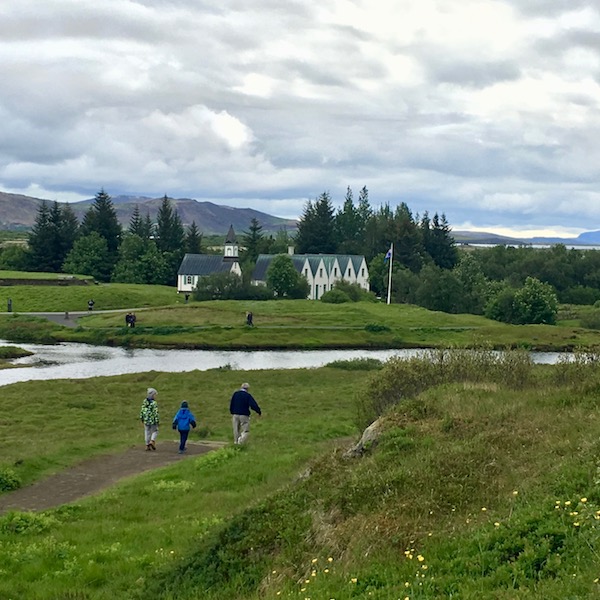
Next, explore the valley and lake, where you’ll see the historic sites, including one of Iceland’s first churches. Along the Oxara River, you can find the ruins of Viking camps, called budir.

Top extra activity outside the park: Laugarvanshellir Cave People Tour

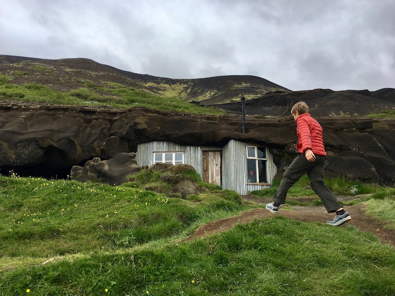
This lovely tour is still unknown to most tourists (as its new in 2017). Located outside the park on 365 toward Laugarvatn, you’ll see the little house (think hobbit house) cut into the hillside before you arrive at the small parking lot. Go into the tent that houses a small tea room to purchase a tour, which is led by an enthusiastic guide. In fact, days later, our kids commented he was their ‘favorite Icelander they’d met’. The tour takes about 40 minutes, and takes you up the hillside to see the cave an Icelander couple made into a rudimentary home at the turn of the 20th century. Later, another couple inhabited it for a short time. The single room house is historically restored, and includes a sheep barn and cow barn built into the rock. While it’s interesting the see the house, the story behind it is even more fascinating; this really is a story of Icelandic pioneering. Learn more at http://www.thecavepeople.is

iceland cave people

Vatnajokulsthjodgardur National Park:

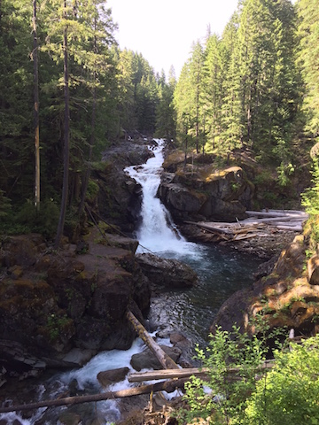
This was our favorite Icelandic national park, thanks to its dramatic volcanic history and glacier. The visitor center at Skaftafell has a lot of good information: start here and pick a day hike to try. We opted for a loop of about 6 km that took us high up the mountain to spectacular views of Iceland’s largest glacier, Skaftafellsjokull, then cut along a high ridgeline to dip back down to stunning Skaftafoss (certainly a highlight of the park). You can opt for shorter hikes, or longer ones, but for any length, be sure to pack many layers for all types of weather, as you’ll be completely exposed to the elements (as you are in most of Iceland).

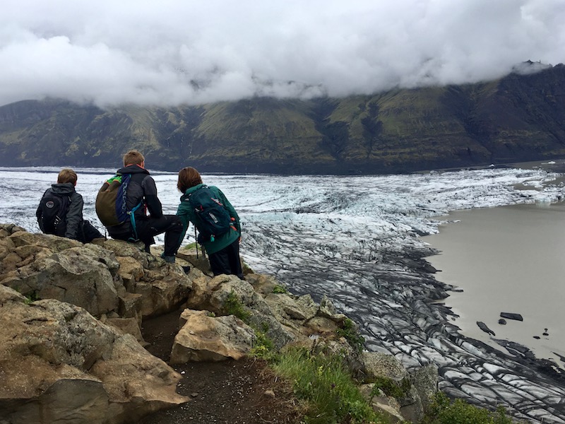
Glacier tour operations are located in the parking lot of the visitor center, which can take you onto the surface of the glacier for about $40-60 per person. You are not permitted to walk on the glacier without a guide, as fissures and cracks can be unpredictable. We opted to skip the glacier tour and were satisfied with our excellent views via the hike.

This national park is pretty massive, and offers plenty of F-road goodness for those venturing north, but families can certainly get a feel for the area from the southernmost Skaftafell entrance without venturing beyond Jokulsarlon glacial lagoon.

Top extra activity outside the park: LAVA Centre

Before you enter the national park, stop at the brand new LAVA Centre located at Hvolsvollur. This highly interactive, tech-heavy museum answered a lot of our questions about the geothermal and volcanic nature of the region, which really helped us understand the lava fields, glaciers, and volcanos we saw the following days. The fairly steep entry price (still on par with entry to other museums we visited) is well worth it: get the family pass if it applies to you, to save some money.

LAVA Centre

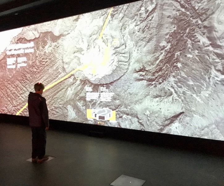
The museum is divided into several rooms you walk through in order, each with hands-on activities and digital displays. It’s truly hard to describe how great these exhibits are, but I’ll try: one room mimics the properties of ash, giving you a taste of how it feels to be blinded by it in an eruption, and another room allows you to spin a giant globe, showing the shifting of tectonic plates over millions of years. Start with the 15 minute film and follow the map through the rooms from there. All displays are in English.

Snæfellsjökull National Park:

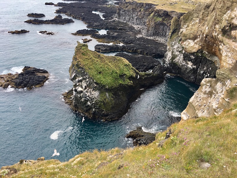
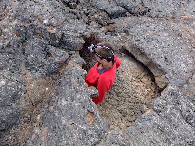
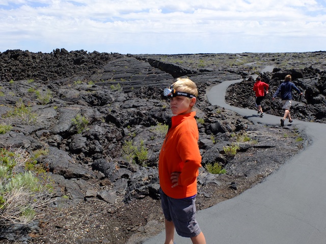
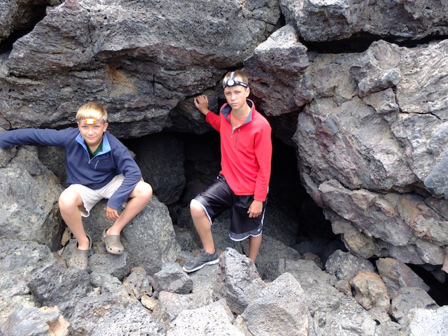
Located on the west side of Iceland on the Snæfellsnes Peninsula, Snæfellsjökull features a big daddy volcano (unfortunately covered in cloud during our visit), as well as black sand beaches with interesting rock formations, caves and lava tubes, and cinder cones. The park is located past the fishing village of Olafsvik, with a visitor center located at the space ship-looking lighthouse about three-fourths of the way through the park. See great views of the ocean and sea stacks here, then book a cave tour a few meters down the road. If you don’t want to spend the money (it’s not cheap), do as we did and take the short self-guided tour of the main cave entrance. All around the cave are smaller lava tubes you can (but probably shouldn’t) climb into.

Iceland

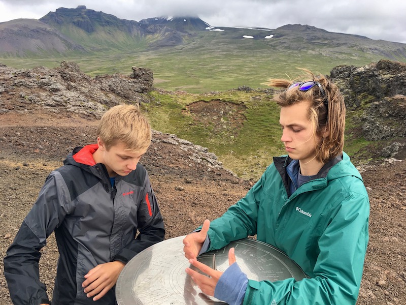
There’s also a well-marked cinder cone in the park, which is an easy climb with metal steps, and affords great views. We loved that at the top, a circular plaque names all the nearby mountains and volcanoes so you can identify each one.

Top extra activity outside the park: Settlement Center 

At the bottom of the peninsula, you’ll first enter Borgarnes on 60. Go to the Settlement Center, one of the best museums in the region. It’s located by the harbor in a warehouse, but inside, you’ll see the history of the Icelandic settlement era and learn more about its famed Sagas.

Mount Rainier National Park two-day itinerary

On the right day, Mount Rainier National Park can rival the scenery beheld at National Park greats such as Glacier and Canada’s Banff or Jasper.

mount-rainier

Often hidden in cloud, the mountain framed by blue skies is nothing short of breathtaking, and on clear days, the views from the Paradise end of the park reach from Mt. St. Helens to Mt. Hood to Mt. Baker. The day we arrived, looking from volcano to volcano across the Pacific Northwest, we felt awe and respect standing along the famed Ring of Fire.

Mount Rainier National Park is large, but 97% of the park is dedicated wilderness, which means families can reasonably see the best day hikes and visitors centers in two full days, or one full day and two half-days. The order in which you tackle these attractions will depend on how you enter and exit the park. We entered from the north (Seattle) through the White River Entrance, and exited to the south via the Stevens Canyon Entrance. Our lodging was located on the south end, so we toured what we could on the north end (Sunrise) after we arrived, then concentrated on the south end (Paradise and Longmire) for the remainder of our trip.

mount-rainier-national-park

Mount Rainier two-day itinerary suggestions:

Day 1:

Arrival through White River:

white-river

We enjoy entering the park at White River, as this milky-white river gives a good introduction to the volcanic activity on Mount Rainier. The river gets its name from the chalky powder that rubs off granite higher up due to glacial activity. Stop for a picnic at any one of the White River turnouts along Mather Memorial Parkway toward the Sunrise Road turn-off.

Sunrise area hike:

If you’re staying in the Sunrise area, skip the Sunrise Road for now, and head south to sample some Ohanapecosh or Paradise hikes, which will enable you to concentrate on Sunrise on Day 2. However, if you’re staying on the Paradise side, as we did, take the time to detour to the Sunrise Road now, to avoid needing to backtrack tomorrow.

The Sunrise Visitors Center is a good one to hit up for Junior Ranger booklets. Afterward, head to the Sourdough Ridge Nature Trail, which is an easy one-mile loop starting near the Sunrise complex parking lot. You’ll get nice views of Rainier and interpretive signs educating on the flora and fauna. As an alternative, Silver Forest is a two mile out-and-back hike, which starts with informative exhibits en route then moves through an area once-damaged by forest fire. What still stands are the ‘silver sentinels’; long-dead but erect trees that are surprisingly beautiful.

If you want a longer hike, the Naches Peak loop is about five miles, and offers small lakes, views of Rainier, and plenty of subalpine forests. Plus, it takes hikers on a portion of the Pacific Crest Trail, which can be fun.

Ohanapecosh-area hike:

silver-falls-hike

As you drive through the park toward the south, plan to stop for a short hike at either Grove of the Patriarchs or Silver Falls, near the Ohanapecosh Campground. The Grove of the Patriarchs is best if you’re short on time or have very young kids; it’s an easy one mile walk to see old-growth forest along the Ohanapecosh River.

For a longer and more satisfying hike, go into the Ohanapecosh Campground to the day-use/trailhead parking. Take the Silver Falls loop hike, which is about three miles. At the very start, you’ll be rewarded with hot springs activity. Feel the water temperature of the various springs as you go…they get progressively warmer as you get closer to the source of the hot springs. Be sure to detour onto the hot springs loop trail about a quarter mile into the Silver Falls loop, just to the bigger pool that’s jacuzzi-hot. Continue along the Silver Falls trail to the thundering falls along Ohanapecosh River; it’s absolutely worth the mileage! The loop will deposit you back at the campground.

silver-falls

Day 2:

Paradise Visitors Center:

For the Paradise portion of your visit, start early, as the Sunrise parking lots fill up fast in summer. (See below for best time of year to visit.) The Visitors Center offers a nice area of exhibits upstairs, and a 20 minute video that plays several times per hour. We always recommend watching videos to introduce visitors to new parks.

Skyline Trail hike:

skyline-hike-mount-rainier

Right outside the Visitors Center, a network of trails are on offer. The Skyline Trail is one of the most popular hikes in the park, and while we usually shy away from potentially crowded areas, this one is worth it. This loop is over five miles, and takes hikers up in elevation from the Paradise parking lots seemingly to the edge of Mount Rainier itself. The first two miles are steep, but the continuous views of Rainier make this workout less painful, and the crowds drop away the further you go. There are a number of turn-around options in these first few miles; hikers could detour onto the Dead Horse or Alta Vista Trail, and return to Paradise. Everything is well-marked, and rangers are often on-hand at junctions to explain options. Note: the beginning and end of this loop are paved trail, to accommodate shorter hikes for all visitors.

For those wanting to go the distance (recommended if possible), continue up Skyline to Panorama Point, where you can opt between the Low Skyline Trail or High Skyline Trail. Either will continue your loop, but in early season, only Low Skyline is open. When we hiked in June, Low Skyline offered lots of snow across the Nisqually Glacier, which the kids loved. Cramp-ons are not necessary for the Low Skyline Trail, but be prepared to walk through snow (trekking poles are useful).

marmots-mount-rainier

The Low and High Skyline trails merge again to start the long descent back toward Paradise, with an option to cut 1.5 miles off your loop by taking the more direct Golden Gate Trail down to Myrtle Falls, then the lodge area. We opted to stay on the Skyline loop, and were not sorry. The views continue to be spectacular, with creek crossings and wildflowers in the early season. At Myrtle Falls, the trail becomes crowded with visitors for the final few tenths of a mile. Look for marmots along the entire hike: we saw 4-5!

Rampart Ridge Trail Hike:

If you have time to venture further from Paradise to the Longmire section of the park, or if Skyline is simply too crowded on the day you’re visiting,  the Rampart Ridge Trail is a good alternative. This trail is often hiked in summer by the many visitors who do not receive Wonderland Trail permits, and in early season or fall, it’s blissfully empty. The 4.6 mile loop begins at the Trail of the Shadows trailhead, and takes hikers through both wetlands and old-growth forest. The climbs along the loop start out quite gentle, then progress to a series of switchbacks. The reward: views of the valley below and Tumtum Peak. Further along the trail, the views continue, offering sweeping vistas of Longmire and Eagle Peak. When families reach the junction with the Wonderland Trail, a steep descent returns them to Longmire.

Best time to go:

The best time to visit Mount Rainier National Park is mid-June, early July, or September. While coming in June is a gamble (not everything will be open yet, depending on snow pack), it’s far less crowded. Mid-July through August are peak season. Come in fall, and the park will be yours alone!

Where to stay:

Campgrounds:

The campground facilities in the park are fantastic. We really liked the relative isolation and quiet of Ohanapecosh Campground, which is set apart from any visitors centers. The White River Campground is one of the most popular, but with the river nearby, we understand why. Check the national park site for campground information, including which can be reserved ahead of time.

mount-rainier-with-kids

Paradise Lodge:

This national park lodge is beautiful, but located in the thick of things. You’ll get pristine views of Rainier, and have immediate access to some of the best trails (no parking worries!) but also be staying in the midst of the crowds.

Packwood area:

We opted to stay three miles outside the Stevens Canyon park entrance, in the Timberline community of seasonal cabins outside of the town of Packwood. We rented our cabin via VRBO, and were cozy in a retro cabin sleeping six. Renting in the Timberline community, we had access to a community outdoor pool and tennis courts, and enjoyed a nice deck and mountain views, plus a full kitchen for cooking our own meals. There are a few dining options in Packwood (we tried the Blue Spruce Cafe, which served traditional pub food like burgers, fish and chips, and pizza), but you’ll want to do some grocery shopping. Note: AT&T customers will have no cell service in this area.

Have you visited Mount Rainier? Where did you hike and stay?

Leave No Trace principles every family needs to know

With Earth Day coming up later this month, April is the perfect time to talk about caring for our public lands. My kids have heard the Leave No Trace mantra since early childhood, but it’s always good to brush up on best practices for preserving the wilderness we love.

leave-no-trace


This season, Leave No Trace launches a multi-year, Leave No Trace in Every Park campaign. Subaru/Leave No Trace Traveling Trainers will be visiting ‘hot spots’ across the country (severely impacted areas), giving them attention and helping educate the public. I was lucky enough to sit down with one of them to ask top questions most families have about leaving a lesser impact on the wilderness.

Q: I am aware of the seven principles of Leave No Trace. Is there a ‘crowning’ principle in particular families would bear in mind while in the outdoors?

We encourage people to think of the cumulative impact as a crowning idea for the principles. Over one billion people visit federal and state lands each year. If one person leaves an impact such as litter, feeds wildlife, takes an item out the environment, or walks on a non-durable surface it will not impact the outdoor area significantly, but the cumulative effect of these impacts happening repeatedly over time would have a dramatic impact.

leave-no-trace

Q: How does trail cutting or ‘bush-whacking’ hurt the wilderness environment?

We encourage people to walk in the middle of the trails even when they are muddy. If you walk around the mud you will erode the sides of the trail making it wider and you could crush vegetation on the edge of trails.

As trails widen vegetation diminishes and eventually land management agencies will have to fix the trail. Along the same lines, we encourage people to not cut switchbacks since it can result in the hillsides between the trail to erode.

If a group of people wants to hike off trail we encourage them to disperse, rather than hike in a single file. By dispersing people won’t step on the same spot, which can cause a new undesignated trail to form.

learning-leave-no-trace

Q: Could you describe best practices for finding a suitable campsite in backcountry situations when established sites are rare?

If established sites are rare and the land management agency does not have designated spots that are provided for campers to use we recommend the following considerations. Camp 200 feet (the equivalent to 70 adult paces and 100 kid paces) away from water, trails, and other campsites. Find the most durable surface available such as rock, sand, snow, or dry grass to camp on. If you find a site that is showing some signs of impact, such as significant soil compaction, stay there, but if it is only showing small signs of impact leave it alone for the area to recover. Move on to another more durable site that is showing no signs of impact. Bonus: dish washing tips and car camping tips!

Q: What’s the best way to completely put a fire to ash and ensure it’s safely out before leaving?

Fires are a great part of camping; they give us light, warmth, and s’mores! Making sure that we are responsible with our fires ensures safety for you, other visitors, and wildlife.

Before having a fire, ensure that they are allowed in the area you are camping in.

Ensuring that your campfire is out completely before you leave or go to bed is a very important part of camping. First, choose firewood that is no larger than your wrist as it will burn to ash more easily than larger wood. Check local firewood regulations as some areas do not allow wood not from the area to be brought in as it may harbor invasive insects.

backpacking foods for kids

Be sure to burn all wood to ash. Then, you want to guarantee your campfire is out cold. First, use plenty of water and sprinkle it over the ashes: to help the process use a stick to stir the ashes while pouring the water. If the fire area is too hot to touch, it is too hot to leave or go to bed. Bonus: how to build a mound fire.

Q: Tips for carrying out all trash? For instance, our family always unwraps food items as much as possible before departure, so there’s less trash to carry out later. 

We encourage people to take a trash bag along with all of their other essential items for any outing. Repackaging food before heading to the trail helps decrease the amount of trash you will have to pack out. We also encourage people to even pack out all food scraps. Human food is unhealthy for wildlife; they become dependent on humans for food and become attracted and conditioned to human food and trash. Which is unhealthy for both the wildlife and humans. Fruit peels can take up to 2 years to biodegrade and most are not native to the areas they are left.

We like to say, if you weren’t there would it be there?

Q: Young kids naturally enjoy making forts, rock dams, or other ‘structures’ at backcountry campsites…how can they channel this desire to create and explore in line with Leave No Trace practices?

We get this question all the time. It is important to educate children on the importance of Leave No Trace while still inspiring creativity and fostering a sense of adventure to connect kids to the outdoors. We still encourage children to play in nature and still follow Leave No Trace. Kids can still build forts or structures at campsites and then before leaving they can simply dismantle the structures.

If kids want to collect items, first make sure to check the rules and regulations of the area to make sure it is ok to collect something.

We encourage only taking one item instead of several, this generally also makes that one item more important to the child as they often attach a special memory to one item they have really given some thought to during an adventure.

Q: A nitty-gritty bathroom-related question: Leave No Trace has always stated that human waste and soap or shampoo should be 100 feet from water sources. What about rafting companies’ ‘dilution is the solution to pollution’ method? 

Usually in the backcountry, we want to be 100 feet away from any water sources, trails, and campsites when doing dishes or bathing.

However, western river corridors sometimes have different recommendations for human waste and gray water. In river corridors, the river is usually the most durable surface. The rivers in deep canyons present difficulties for the normal recommendations because you usually cannot get 100 feet for gray water or 200 feet for human waste disposal away from the water.

Leave No Trace recommends packing out all solid human waste with a reusable, washable toilet system. Always follow local regulations as some areas allow the use of bag-type systems to pack out human waste. Often, urine and strained gray water are required to be deposited directly into the river.

The old saying goes, “dilution is the solution to pollution.”


Thank you, LNT, for helping educate Pit Stops for Kids families!

Valley Forge National Historic Park

After three days sightseeing in Philadelphia, I have to admit that I didn’t think Valley Forge could possibly compare. In fact, we nearly skipped this stop en route to Gettysburg, PA. We were so glad to stayed the course! We ended up spending almost three hours at Valley Forge, and could have used more time.

valley-forge

The way this national historic park is set up, visitors start at the Visitor’s Center, see a short film, then set out to see the rest of the (large) site either by driving tour or bicycle. I supposed you could also walk it, but it would take quite a bit of time. As it is, if you have a few hours, you should drive, and only bike the tour if you have a full half day to devote to it. Note: if you go this option, bike rentals are available in the parking lot of the Visitor’s Center.

valley-forge

We opted to drive, so we picked up a map and headed out after checking out the exhibits in the center. By following the self-guided tour (well marked en route), families see nine major sites, including replicas of the wood-hewn huts inhabited by Washington’s army during the long winter of encampment, Washington’s headquarters in a historic farm house, and canons and other trappings of the war. You also see the inner and outer defenses of the camp, and a few ‘new’ additions from the early 20th century, like a stone chapel and several statues.

valley-forge

The drive is beautiful, but bear in mind: it’s easy to get off-course. Follow the brown tour route signs religiously, and you’ll be ok. The whole loop takes approximately 30 minutes if you drive it without stopping, but you’ll want to stop at at least 2-3 locations. We took two hours.

Valley Forge is a good location for families with kids of any age: the drive between sites is short, and every area has plenty of space to run on the grass, explore a creek, or just run a bit. Living history docents in period costume were present at two of the stops we made (on a summer weekday).

Date last visited:

June 2014

Distance from the interstate:

Two minutes off I-76

Dining:

We saw one snack shop by the bike rentals in the main parking area; otherwise, there are plenty of picnic areas. We ate our picnic lunch near the Visitor’s Center because we thought it would be our only chance. Not so: excellent picnic spaces are on offer throughout the driving tour. If we had it to do over again, we would have picnicked at any of many scenic spots overlooking the encampment.

Admission and Hours of Operation:

This national historic site is FREE, and open from sunrise to sunset.

Directions:

The Visitor’s Center is located at 1400 North Outer Line Drive, King of Prussia, PA. From I-76, take Exit 328 A and US 422 West, then Valley Forge Exit to Route 23 West. Follow signs.

Cave spelunking at Craters of the Moon National Monument

For families driving through Southern Idaho en route on I-84 or toward Yellowstone National Park, a stop at Craters of the Moon National Monument is well worth the time. This park of lava tubes and geological displays is visually stunning with its rocky volcanic landscape and cinder cone, but the true wonders are below ground. The highlight for our family was certainly the cave exploration within the park.

spelunking at Craters of the Moon

Start at the visitor’s center at the park entrance, and watch a short film on the park, then obtain a cave permit. (Permits are required to enter any caves in the park in an effort to protect bats from a common bat disease.) Once you have your permit (and enough flashlights or headlamps for everyone in your party), head out on Crater Loop Road, and follow signage to the cave area. You’ll see a parking area and paved path to the lava field with five caves. We toured the Dewdrop Cave (small and good to start with), the Indian Tunnel (large but still well-lit), and the Boy Scout Cave (dark, icy, and requiring much scrambling). If you have adventurous kids in your group like we have, they’ll also want to explore additional lava tubes running throughout the beds.

lava beds

Note: You’ll want sturdy shoes with good grip in the caves, as well as lights (headlamps are best). Keep kids close to you, because there are many ways to go inside the caves and many small tunnels that are tempting to explore. Be aware of icy rocks.

If cave spelunking isn’t your thing, the Crater Loop Road also includes numerous view points, a short hike up a cinder cone, and day hikes. There is a campground at Craters of the Moon which is visually beautiful but low on shade or wind protection; I’d recommend it for RV campers, not tent campers. The visitor’s center has an indoor atrium where families can eat bag lunches, but no outdoor picnic areas. Don’t forget to get the kids’ National Parks Passports stamped!

Craters of the Moon

Date last visited:

June 2013

Distance from the Interstate:

1.5 hours (right on US Highway 20).

Admission:

Car fee is $8. Campground fees may apply.

Operating hours:

Visitor’s Center: 8 am to 6 pm during summer months. Call for opening season dates: 208-527-1335

Directions:

Craters of the Moon is located off US Highway 20/26 between Arco and Carey, Idaho.

Uncrowded Yosemite: backpacking Yosemite National Park with kids

Would you believe that in July, in the center of Yosemite National Park, we enjoyed an entire day where we never saw another soul? It’s possible, provided you depart from the usual tourist destinations in the valley and explore Yosemite backcountry.

Yosemite backcountry with kids

Backpacking Yosemite National Park with kids:

We chose to hike a portion of The John Muir Trail, a 211 mile path between Happy Isles in Yosemite Valley and Mt. Whitney in the California desert. While hardcore backpackers will hike the entire length in as little as 15 days, the Yosemite National Park portion of the John Muir Trail makes for a nice escape for backpackers with less time (or young kids). Backpackers hiking the John Muir trail in Yosemite traditionally start at the base of Vernal Fall in Yosemite National Park, and climb upward past Vernal and Nevada falls, Half Dome, and Little Yosemite Valley campground while making their way toward Tuolumne Meadows. For our John Muir Tail trip with young kids, we decided to tackle the John Muir Trail in reverse, which allowed for more downhill sections of trail and fewer crowds until the end of our journey.

Planning a Yosemite backcountry trip:

Backpacking the Yosemite National park backcountry with kids involves planning. Anyone planning to hike any portion of the John Muir Trail must obtain a Yosemite wilderness permit. Permits can be secured up to 168 days prior to the date desired, and for summer backpacking in Yosemite, reserving a permit the full 168 days out is recommended.

Upon arrival to Yosemite, you’ll need to check in at a Yosemite National Park Wilderness Center, where you’ll pick up your permit as well as bear canisters if you don’t have your own. Bear canisters must be used to store all food and scented items such as toothpaste, medications, and lotion, and can be rented (for only the price of a deposit). You’ll need to leave space in your packs for these.

If you plan to hike Half Dome, Half Dome permits are required, and they are separate from backcountry permits (though you can obtain both simultaneously). And if you plan to stay a night before or after your backpacking trek in Yosemite National Park (recommended), be sure to secure lodging early, as this is one of the most crowded national parks in America. Backpackers can also make use of free backpacker campgrounds the day before and after their backpacking trip.

Mist Trail Yosemite National Park

On the John Muir Trail:

Day 1: Tuolumne Meadows to Sunrise Lake (3 miles)
In order to start our Yosemite backpacking trip in Tuolumne Meadows, we began at the Sunrise Trail Head at Tenaya Lake on Tioga Road. We followed the Sunrise Trail up steep switchbacks to connect with the Forsyth Trail near beautiful Sunrise Lake (a great first night camping option).

Day 2: Forsyth Trail to Clouds Rest and beyond (8 miles)
From Sunrise Lake, we continued to follow the Forsyth Trail to intersect with the Clouds Rest junction, leading 2 miles to arguably the best viewpoint in Yosemite National Park. From Clouds Rest, hikers can see the entire Yosemite Valley, including an unique view of Half Dome. Note: the pinnacle of Clouds Rest is fully exposed, with steep drop offs on each side. This is not a place for young children or anyone with vertigo or a fear of heights. Since I fall into that category (hiking with a small child), we viewed the Yosemite landscape from just .2 mile below the top, which also offers wonderful vistas.

Hikers can continue past Clouds Rest to intersect with the John Muir Trail several miles later, but as this section of trail is still exposed and at great heights, we opted to return the 2 miles back to the Forsyth Trail and join the John Muir Trail much earlier. This first section of John Muir winds through old growth forest alongside Sunrise Creek, and affords several nice camp sites adjacent to this water source. This section of the John Muir Trail is less traveled, but we were still surprised to find we didn’t encounter a single hiker all evening, night, or morning.

Clouds Rest Yosemite National Park

Day 3: Sunrise Creek to Little Yosemite Valley (5 miles)
Day 3 took us along the John Muir Trail from Sunrise Creek into Little Yosemite Valley. This backpackers’ haven offers numerous campsites along the Merced River (perfect for swimming in after a long day hiking!). Though lively, Little Yosemite is a fun oasis for hikers, offering conversation and companionship around the communal fire pit after days of relative isolation.

En route to Little Yosemite Valley, the John Muir Trail offers views of Half Dome, and the steady accent of hikers navigating its cable system to the top. Should you wish to ascend Half Dome yourself, the trail intersects with the final 2 miles of the Half Dome Trail mid-way through your hike down to Little Yosemite. Note: this is another steep, exposed trail. Though children can ascend it, be advised that very small kids may not be able to reach the cables, essential to a safe ascent. Our 13 and 11-year-olds could make the trek, but not our seven-year-old. For those not challenging Half Dome, it’s fun stop on John Muir Trail or Little Yosemite Valley and use binoculars to watch the climbers.

Day 4: Little Yosemite to Valley Floor (4.5 miles)
Our final day on the John Muir Trail led us down from Little Yosemite Valley to spectacular Nevada Fall, where the trail splits into the John Muir or the popular Mist Trail. We opted for the Mist Trail in order to glimpse the best views of nearby Vernal Fall, but the steps descending both falls are steep and can be slippery when wet. Be advised that the Mist Trail gets crowded with day hikers, and can be hard to navigate with overnight backpacks. The option of continuing on the John Muir Trail has its own set of disadvantages: it’s a longer route to the valley floor, and more exposed, providing little shade.

Safety on the John Muir Trail and in the Yosemite backcountry:

In addition to dizzying heights, bears, and crowds near the valley floor, backpackers need to be aware of the significant elevation gains to be experienced on the Yosemite section of the John Muir Trail. Elevations reach over 9,000 feet, necessitating plenty of water intake to prevent headaches and nausea. Other wildlife can pose a threat if hikers are not alert, including rattlesnakes — we encountered the biggest we’ve ever seen at Little Yosemite Valley.

Getting to and from Your Car:

Whether you hike the John Muir Trail from the valley floor up or from Tuolumne Meadows down, as we did, you’ll need transportation back to your car at the end of your trip. Yosemite National Park offers free shuttle service throughout the valley, but to travel to Tuolumne or vice versa, you’ll need to take Yarts, a paid shuttle service with stops in Yosemite Village and points throughout Tuolumne. Hikers cannot make reservations in advance for Yarts, and though we were told busses never fill up, that was not the case. Be sure to be at the stop before the allotted time and have cash in hand. One-way tickets were $8 at the time of our visit.

Manzanar National Historic Site

If you’re driving along US Highway 395 through California, take an hour or so to stop at the Manzanar National Historic Site, the site of a World War II Japanese-American Internment Camp, outside of Bishop, CA. Built only in 2004, this National Park Service site is wonderfully well run and free for visitors.

Manzanar internment camp

When you enter the site, you’ll be struck by the stunning high desert views and stark isolation, and the first thing you’ll see is the ominous guard tower. Visitors have the option of a three mile driving tour of the barrack areas, or a stop at the interpretive center. I recommend starting at the latter, especially with kids, as this center does a great job of explaining Japanese internment during World War II. Start with the 22 minute film, then wander the auditorium (once a dance hall for the interred), looking at all the fantastic exhibits. Kids are immediately drawn to the display of what a barrack looked like inside, complete with kids’ toys and clothing, and the descriptions of school in the camp (you’ll even find a year book for middle schoolers).

manzanar

The National Park rangers on-site are friendly and very knowledgable, and there’s a Junior Ranger option for kids. We walked part of the driving tour afterward, to experience a bit of the scenery (the Sierras are stunning) and camp-life of the Japanese-Americans at this time in history.

Date last visited:

July 2012

Distance from the interstate:

Right off Hwy 395.

Hours of operation:

The outdoor sites are open every day, dawn to dusk. The interpretive center is open 9:00 am to 5:30 pm in the summer season, and 9 am to 4:30 pm in winter (November 1-March 31). Closed Christmas Day.

Admission price:

Free

Dining options:

None. And most times of year, it’s either too hot, too windy, or too cold to picnic here. There are nice bathrooms and water fountains for drinking and filling up water bottles.

Directions:

Manzanar is located nine miles north of Lone Pine CA (and just south of Bishop, CA), right off Hwy 395.

Muir Woods National Monument

Nestled in the lush hillside just minutes from Mill Valley, CA, Muir Woods National Monument is a must-do for families visiting San Francisco’s Bay Area. Only minutes outside of the city, it makes for a perfect pit stop en route to San Francisco or a nice day trip to escape city crowds.

muir woods

Called a ‘tree lover’s monument’, Muir Woods is a very accessible park of walking trails and visitor information on California redwoods. Visually breathtaking, the paths take families through groves of redwoods, past creeks, and among ferns. Because multiple loops are available, families with kids of all ages and abilities can enjoy Muir Woods. On our visit, our seven-year-old was only up for the 1/2 hour loop, while my older boys wanted to go farther, so we easily split up with one adult on each trail, meeting up at the visitor’s center later. The longest route only took us approximately 45 minutes (the map calls it 1 hour), and takes visitors on a trail above the forest floor for a different perspective. Families who want even more hiking have many additional trails to choose from just outside Muir Woods proper.

cathedral grove

Whatever route you take, it’s well worth the effort to make it as far as the Cathedral Grove, where the towering trees replicate the sanctity of a cathedral dome. (Quiet is requested as you walk through this area, and the effect is very peaceful, even with a gang of kids in tow.) The rangers stationed at the various information stations are very helpful and during our visit, engaged the kids with birding books and tree charts. There is a gift center with lots of tempting souvenirs, and a small cafe. Families can also picnic. Tip: This park gets crowded. On days when the parking lot is full, be prepared to walk some distance from street-side parking spaces, or take the shuttle, running from Mill Valley.

muir woods

Distance from the Interstate:

Just off Highway 101.

Admission price:

The monument is only $7 per adult and free for kids under 15 (yes, 15!). A national park annual pass will also get you in.

Hours of operation:

Park hours vary by season, but generally, is open at 9 am and closes at sunset.

Food services:

A cafe is on-site, as well as picnic areas. Families can’t bring food (other than water) onto the Muir Woods trails, but food is permitted on the additional trails outside the park.

Directions:

Muir Woods is 11 miles north of the Golden Gate Bridge. Take Highway 101 to the Highway 1/Stinson Beach exit. Follow signs to Muir Woods. Warning: the road is very windy! RVs are not permitted. The shuttle, running during the busy summer season, is a great way to go, to avoid parking hassles. Pick up the shuttle from Mill Valley (operated by Marin Transit).

Note: Muir Woods has a Kidscore of 84. Learn more about Kidscore.

Winter camping: extend your outdoor travel season

‘Tis the season for everyone at the Around the Campfire community to be talking about winter camping. What’s quickly become apparent, however, is that everyone’s interpretation of ‘winter’ and ‘camping’ is different. As an avid camper and backpacker, I’m glad to know so many versions of outdoor overnights exist; no matter what your comfort level or geographic location, there’s a way to continue to camp with your family in the winter months.

camping-in-winterUnless you’re a hardcore snow camper setting out on snowshoes or skis (next month, my family and I will be that brave!), you’ll need think outside the box to get full enjoyment out of your winter camping experience. The following tips will ensure happy campers while enjoying campgrounds and recreational sites during the winter months:

1. Seek out alternative shelter. You don’t need an RV to camp in winter! If you’re camping in a wintry climate that eliminates the possibility of tent camping, look for a state or national park that offers overnights in yurts, cabins, or teepees. Oregon State Parks offers all three, complete with heaters, electricity, and cozy beds. And if you camp in a less developed campground, take a look at this review for bringing a heat source with you! In fact, winter is our favorite season to camp in state parks: reservations for those coveted yurts are easier to come by, and parks are nearly empty!

2. Go south or go coastal. An obvious solution, if you can swing it, traveling south to camp rewards families with the same low crowds in weather that might feel downright balmy to northerners. My favorite picks include Georgia’s Reed Bingham State Park and Florida’s Florida Caverns State Park. For those in driving distance of coastal regions, heading toward the shore or beach can ensure milder weather. Plus, those seasonal storms off the ocean can be exciting (as long as you’re prepared!).

3. Sandwich backcountry overnights with lodge or hotel stays. Programs like CascadeHuts, which operates a network of backcountry huts in the Mt. Hood national forest of Oregon, provide warmth, shelter, and safety to backcountry campers. (We’ll be reviewing our own experience hiking the Mt. Hood wilderness with CascadeHuts next month!) Similar networks exist in or near most national parks, providing families with a string of cozy accommodations. When tackling difficult camping adventures such as this (especially for the first time), plan to sandwich outdoor stays between nights in hotels or lodges with more of the comforts of home.

4. Carry the right gear. Obviously, the more comfortable your family is, the more fun you’ll have. For winter camping (even in mild climates), we bring down, 0 degree sleeping bags (Kelty makes good quality ones for a reasonable price), propane heaters, and lots of extra clothes so everyone has dry layers. In snow, appropriate clothing is a must, and in any area, hats, gloves, and raingear are a good bet.

5. For a winter experience without the overnight, seek out sno-parks. Most mountainous interstates and highways have several sno-parks along its route: look for them as you would rest areas or service stations. In addition to providing some quick snow fun for kids, sno-parks often boast cross-country ski trails, winter animal sanctuaries, or sledding hills. Overnight camping is sometimes permitted (though you’ll need to go prepared for a night in the elements).

Lake Quinault Lodge, Olympic National Park

Built in 1926 on the south shore of Lake Quinault on the lush and beautiful Olympic Peninsula, Lake Quinault Lodge is one of the national park system’s most beautiful and timeless historic lodges. Charming when approached from the street (South Shore Road), Lake Quinault’s best side is to the north, where the back of the lodge opens upon a cheery deck and lush, sloping lawn to the lake shore.

Lake Quinault

Stepping through the front doors, visitors are greeted by a cheery fire in the lobby fireplace, plush leather sofas, bookcases and carefully arranged tables, and floor-to-ceiling windows looking out to the lake. Though certainly tranquil, the lodge is family-friendly; just downstairs from the lobby resides a full game room complete with ping-pong and pool tables, a few arcade games (requiring quarters), and a surprisingly large heated indoor pool. Croquet sets can be rented for the lawn, and in summer, canoes are available to lodge guests. Our kids spent a fair amount of time playing on the large lawn, and exploring the lake shore.

Lake Quinault

Lake Quinault is definitely a destination lodge and makes for a great ‘base camp’ while visiting Olympic National Park (home of one of only three temperate rain forests in the world); located just inside the park boundary, a network of hiking trails lead into the forest from directly across the street, many of which are perfect for families. Ask the lodge dining room to pack a picnic lunch for you and make a day of it, or hop in the car to explore more of the park’s varied terrain (the beaches at Kalaloch are 30 minutes north on Highway 101, and further, the Hoh Rain Forest Visitor Center provides more hiking opportunities). Lake Quinault also offers a selection of rain forest tours year round; ask at the front desk! 

Lake Quinault

Extra Tip: Spring is a great time of year to experience Olympic National Park! Crowds are low, deals abound, and since you can plan on rain fall year round, weather is not an issue!

Date last visited: March 2011

Distance from the interstate: Lake Quinault Lodge is just under two hours from I-5 at Centralia, WA (three hours from Seattle or 3.5 hours from Portland).

Room Rates: Lake Quinault offers several room categories, from traditional lodge rooms featuring either one king bed or two queen beds (starting at $95 at time of publication), to Fireplace Rooms and Boathouse Rooms. Families may prefer a more contemporary Lakeside Room, located in a separate building adjacent to the main lodge and sleeping up to six (starting at $130).

Lake side room

Dining options: The main dining room at Lake Quinault, The Roosevelt Room, is what we’d call kid-friendly while still requiring best behavior. The ambiance is lovely, and the food is good, but it’s special-occasion status: dinner for our family of five, without beverages, came to $100. Where the lodge really shines is breakfast: our kids couldn’t wait to order their house-made hot chocolate with whipped cream and chocolate drizzle each morning, and the sweet potato pancakes got me out of bed quickly, as well. For a more casual dinner, we recommend The Salmon House Restaurant, located one mile further down South Shore Road at the Rain Forest Resort Village. The views of the lake are just as majestic, the service is friendly, and the prices are more reasonable for feeding a hungry family.

Lake Quinault Lodge

Directions: From I-5 North or South, take exit 104 at Olympia (Aberdeen-Ocean Beaches) and head straight west to Aberdeen-Hoquiam. From Hoquiam, go north on U.S. 101 for 40 miles to milepost 125. Turn right on South Shore Road and go two miles to Lake Quinault Lodge.

As I disclose with all compensated reviews, Lake Quinault Lodge hosted our stay in part, providing our family with a media room rate and some meals. While we greatly appreciate Lake Quinault’s hospitality, this compensation came with no expectation of a positive review.