A rustic cabin stay at Silver Falls State Park, Oregon

A state park stay can be a great way to safely travel with the family during COVID-19. For up-to-date information on park closures and updates in Oregon, check here.

Located approximately 25 miles east of Salem, Oregon off Highway 22, Silver Falls State Park is the largest in Oregon. With each site tucked away under the canopy of the temperate rain forest, however, you’d never know it. Silver Falls is easy to get to off I-5, but feels a million miles away from the adjacent farmland and towns.
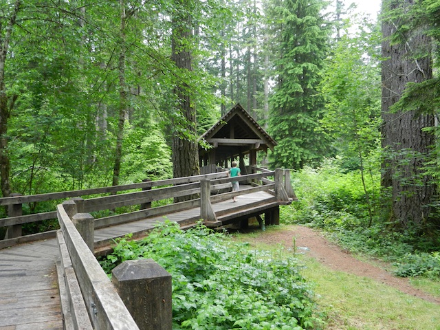
silver falls state park

Silver Falls offers traditional tent and RV camping loops, as well as rustic cabins (similar in amenities to Oregon State Parks’ rustic yurts). Group lodging is available in their conference facilities. We stayed in rustic cabin #10, and highly recommend it for optimal seclusion.
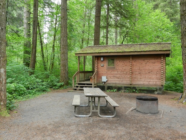
silver falls rustic cabin

The rustic cabins:

Each cabin in the cabin loop (separated from the tent/RV loop by a covered pedestrian bridge) has plenty of space, but #8, 9, and 10 especially are set apart from the others. In fact, you are required to park about 20-50 yards away (depending upon cabin) and cart your supplies in by provided wheelbarrow (which the kids thought was half the fun).

Each cabin has two basic rooms: a front room with a table and four chairs and a futon that converts to a double bed, and a back room with a built-in bunk-bed and additional double bed. The cabins have electricity and heaters, but no bathrooms or running water. Bathrooms with hot showers are a short walk away (and exclusive for the cabin loop) and running water is within yards of each cabin at outdoor faucets. Cabins also have porches of varying size (the ones right on the loop have larger ones, whereas #8-10 have smaller ones) and fire pits and picnic tables.
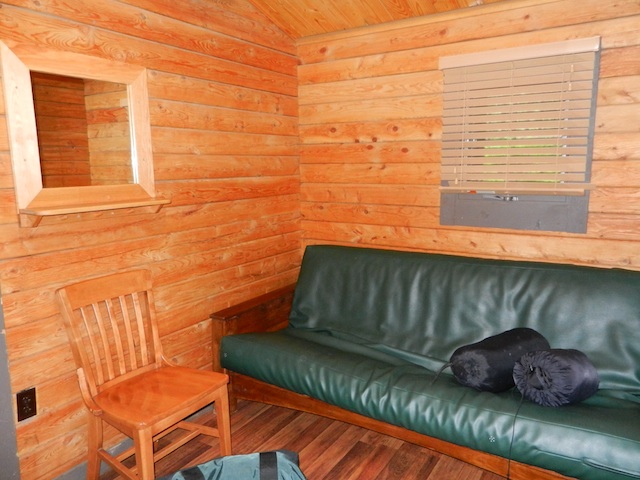
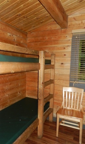
rustic cabin silver falls state park

rustic cabin bunk beds

No cooking is allowed in the cabins, but BBQs can be set up outside, and we simply used our camping cookstove at the picnic table. You’ll want a cooler with ice for perishables, as there is no mini-fridge. Right behind Cabin #10 is a short woodland trail leading directly to the banks of Silver Creek, which makes for lots of fun exploring for kids while parents are relaxing (or more likely, unpacking).

Tip: Stay on the trails, because poison oak is abundant! If you have young children, be aware that though hidden behind trees and vegetation, the road leading to South Falls is quite close to the cabins. Adventurous children could wander there.

Things to do in the state park:

In addition to area road biking and fishing, Silver Falls is a hiking mecca. You’ll want to reserve at least a half day, if not a whole day to exploring the Trail of 10 Falls, the trailhead of which is located past the day lodge in the day use parking area. This is a challenging loop of, you guessed it, 10 waterfalls, and these aren’t just minor rapids, either. Four of the ten are large enough that the trail arcs behind them, for hikers to get a behind-the-scenes view, and all are spectacular.
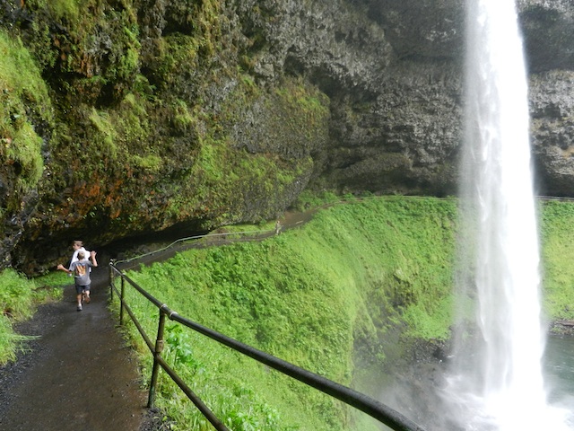
trail of 10 falls

The entire loop is 8.7 miles, but you don’t have to commit to that length. The first waterfall, South Falls, is within yards of the trail entrance, and on a paved walkway. After peeking behind it, hikers will find the Canyon Trail (Trail of 10 Falls) which will take you another 3/4 of a mile or so along the lush canyon floor beside Silver Creek to Lower South Falls, which is also definitely worth seeing. From there, continue on the Canyon Trail another mile to North Falls (and beyond) or look for the Maple Ridge Trail 1/3 of a mile beyond Lower South Falls for a short-cut back to the trailhead (and parking lot). The Maple Ridge Trail starts out with some tough switchbacks, but evens out on the ridge to make an easy jaunt back. (If you go this route, your entire hike is just over 2 miles, and you see two major falls.)
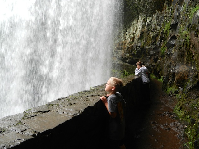
south falls

Near the trailhead, there’s ample picnic grounds, as well as a swimming area. The highs were only in the low 70s during our visit, so we didn’t swim, but this section of Silver Creek is deep and still, and there’s a nice grass area surrounding it.

And yes,  the area has some wildlife worth watching too. There are warnings about the bears and mountain lions in the park, so with the kids, consider going nearby and preferably during the day. For a night safari, ensure professionals accompany you.  On the fun side, carry your thermal binoculars along. Thermal imaging has many limitations, so the binocular may not give you the best picture, but cats barely come out in the daylight- don’t miss them.

Distance from the interstate:

25 miles from I-5

Cabin and camping rates:

Cabins are approximately $45/night in peak season. A campsite is as low at $15.

Dining options:

There are a few small towns near Silver Falls, and the lodge at South Falls offers limited cafe hours, but in general, you’ll want to pack your own food in.

Directions:

From I-5, take Highway 22 east from Salem, Oregon. Follow signs to Silver Falls State Park.

Palm Springs Aerial Tramway and Mt. San Jacinto State Park

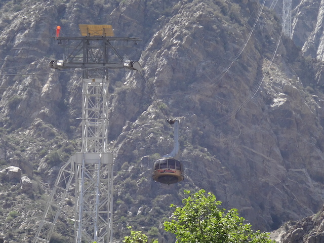
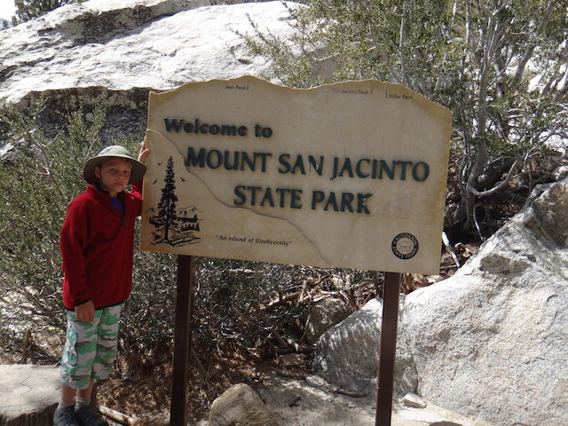
If you have a few days in Palm Springs, a trip to the Aerial Tramway  is well-worth your time. This ‘world’s largest rotating tram’ takes visitors from the desert floor to over 8,000 feet in elevation to Mt. San Jacinto State Park in just a few minutes. The tram ride itself is fun for everyone (even those who experience ski resort gondolas and trams often), but the real gem is at the top. Mt. San Jacinto Park offers 54 miles of hiking trails in over 14,000 acres of alpine wilderness. Everyone can enjoy the novelty of soaring from a desert environment to an alpine forest within minutes, and once there, they can spend as much time as desired exploring the mountain scenery.

palm-springs-aerial-tramway

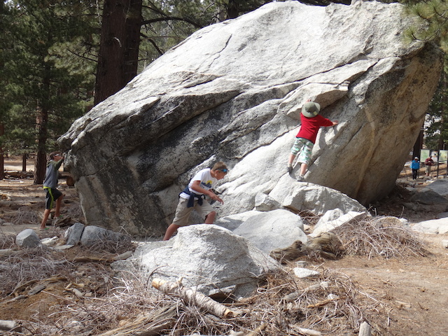
Hiking trails are well-marked, the three major trails offering something for everyone: the easy 1.5 Desert View Trail can be done in under an hour, or the Round Valley Trail offers a 4.2 mile loop more suitable to families with older kids. There’s also a 12 mile loop up San Jacinto Peak for experts. Once families depart the tram at the Mountain Station, they follow a paved walkway down to Long Valley, where the wilderness awaits. Since we’d done a lot of hiking in previous days of our trip, we opted to let the kids rock scramble and play at will in the valley area. In winter, an Adventure Center in the valley offers sled and snowshoe rentals plus gear.

san-jacinto-state-park

Tramway tips:

  • The temperature changes dramatically between the desert floor and the Mountain Station, so families will need to bring extra layers. A good rule of thumb: expect the temperature to drop by 20 degrees.
  • Buy tramway tickets online to ensure your departure time. If you buy tickets at the Valley Station, expect a slight to moderate wait. During the time of our visit on a weekend during Spring Break, we waited an hour before boarding.
  • Expect the process of boarding to take awhile, from the time you park and take a tram bus to the entrance of the Valley Station to the time your departure time is called to board.
  • Due to the time and cash investment, plan to spend the better part of the day at the Mountain Station area.

Dining:

There are ample opportunities to purchase food, both at the Valley Station (where there’s a snack area and bar) and the Mountain Station (where families find a quick service type restaurant with pizza, sandwiches, and the like) as well as a sit-down dining experience. Outside food is also allowed, and picnic tables are located at both stations. Bring water bottles and fill them at drinking fountains.

aerial-tramway

Distance from the interstate:

The tramway is located six miles from downtown Palm Springs off I-10.

Admission cost:

Adult tramway tickets are $23 and children’s (12 and under) are $16. Discounted tickets can be had after 4 pm. Hours vary by season.

Directions:

From Palm Springs, take Highway 111 to Tram Way.

Black Hills Road Trip Itinerary: Exploring South Dakota’s Wild Side

When families ask me where they can find outdoor adventure, beautiful scenery, American history, and affordable accommodations, the Black Hills of South Dakota are at the top of my list. The first time I visited the Black Hills, I was blown away, and I feel just as passionate about this family-friendly destination today. Located on the western end of the state, the Black Hills are within easy driving distance of Rapid City, or can be accessed via I-90 on a cross-country road trip.

south dakota road trip

Black Hills Road Trip Itinerary

From Rapid City, your Black Hills road trip should take you about a week, though families could of course take longer if desired. It’s easy to tent or RV camp in the area during the summer months, but a nice aspect of the Black Hills is the availability of affordable travel lodges, roadside motels, and cabins.

needles-highway


Start By Exploring Wild West Towns

  • Day 1-2: Drive about a hour from Rapid City to Deadwood, home of Wild Bill Hickok, Calamity Jane, and Seth Bullock. Parents, you may have seen the HBO show by the same name. Deadwood doesn’t disappoint, with a historic downtown and multiple museums. Stroll the main street, stopping at Saloon 10, where Wild Bill was shot to death by Jack McCall more than a century ago. Kids will enjoy the sawdust on the floor and the historical photos on the walls, and the saloon is open to minors until late evening. Families can also visit the cemetery where Calamity Jane and the others are buried. Stay at any number of affordable Deadwood hotels, augmenting your history tour with some outdoor recreation on the nearby Mickelson Trail, a gravel-paved bike path and rail trail that winds from Deadwood 109 miles through the Black Hills. Read more about Deadwood activities for families.
  • Day 3: From Deadwood, drive south on Highway 385 to Keystone. This town is best known as the gateway to Mount Rushmore, and as such, is more touristy than historic. Instead of staying the night here, stop to enjoy a few family-friendly activities, like the Rushmore Tramway Adventures, then spend a few hours of the day at Mount Rushmore National Memorial. In the evening, drive on to the small Wild West town of Custer.

deadwood shelby bell

  • Day 4: Families will find lots to do in Custer, starting with the downtown area’s historic buildings and shops. Eat at the Purple Pie Place or Black Hills Burger and Bun (Tripadvisor’s #1 Burger joint in the entire US in 2014, #2 in 2015). For outdoor adventure, 3,000 miles of ATV trails crisscross the Black Hills, and Black Hills ATV Adventures can guide you along some of them just outside of Custer. The Mickelson Trail also goes through Custer and nearby Hill City. Hill City is a good place to rent bikes for the trail for a full or half-day adventure. Stay the night at either Custer Gulch Resort outside of town, or more centrally located Rock Crest Lodge. Read more about Custer activities for families.

Step Into Outdoor Adventure

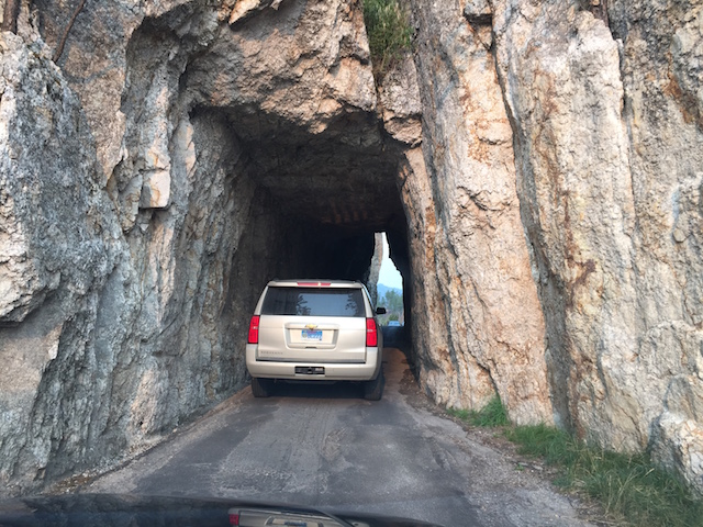
  • Day 5: Dedicate this day to exploring Custer State Park, which many believe to be worthy of national park status. This massive park deserves at least two days of your time. It can be accessed from Custer, allowing you to stay in town, or families can camp or stay in cabins within the park. Begin with an overview of the park via the Needles Highway Scenic Drive (part of the Peter Norbeck National Scenic Byway). Kids will love going through rock wall tunnels and around hairpin turns (take it slow!). Keep your eye out for mountain goats and bison along the drive. Next, check out one of the lakes in the park for some water recreation; Sylvan Lake rents watercraft and has a family-friendly swimming area. After getting some energy out, take the Wildlife Loop Road to see the buffalo corrals and prairie dog town at the other end of the park.
  • Day 6: The next day, head out on a few hikes. Sturdy hikers will want to tackle Black Elk Peak (formerly Harney Peak), a strenuous seven-mile round trip hike to a lookout tower with exceptional views. The less ambitious can try Cathedral Spires (only three miles round trip) or Badger Clark Historic Trail, which gives an overview of the human history of the park. Read more about Custer State Park.

visit south dakota

End In Rapid City

Rapid City is a fun, small city worth exploring for a day in its own right. It has a recently renovated downtown area, fun eateries, and inventive and artsy shops. There’s even a family-friendly pub and winery in a firehouse!

Ready to explore? Sign up for a free vacation guide.

This post was written in partnership with Travel South Dakota. Get more Black Hills travel ideas here.

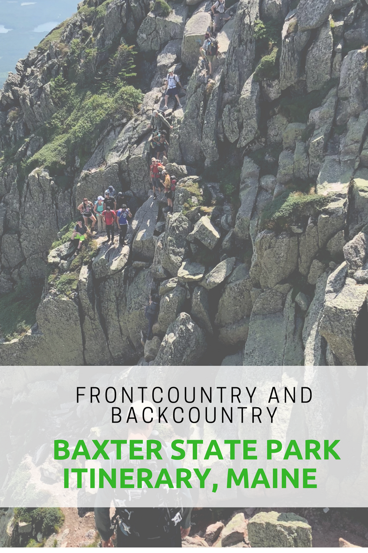
Maine with kids: Baxter State Park backcountry itinerary for families

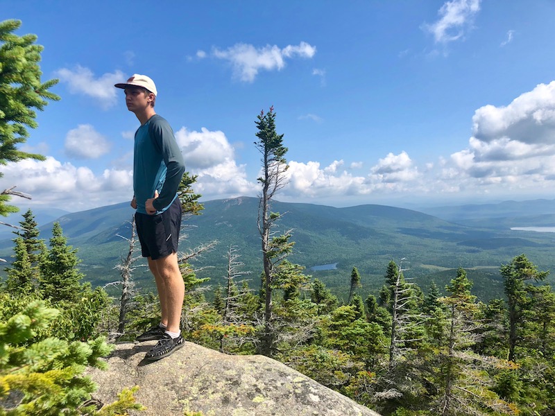
Baxter State Park is Maine’s largest expanse of untamed public wilderness. With almost 210,000 acres to explore, where do you start? Our Baxter State Park backcountry itinerary for families includes days in the frontcountry enjoying Baxter’s car camping options, several days in Baxter’s backcountry, then a rest day to play and explore before departure.

Baxter’s scope and size is on a national park scale, but unlike national parks, almost every lake, pond, waterfall and stream in the park is accessible only by trail. In very few places in Baxter can you drive up to see anything, and even then, you must drive miles upon miles on dirt roads. In other words, you earn you sightseeing! Baxter limits the number of visitors to the park daily, which means you won’t be rubbing elbows with crowds of tourists. It also means you have to be organized about your trip and get the required permits you need early. Here’s how!

The best way to experience Baxter State Park is by camping, though day permits are available as well (if you opt for that, stay in nearby Millinocket). Here’s our suggested itinerary, after doing most things right and a few things wrong during our five days in Baxter.

Day 1: Frontcountry camp at Roaring Brook Campground

In case you’re not sure, when I say ‘frontcountry camp’, I mean ‘car camp’, or camping via car access. Roaring Brook Campground is about eight miles into the park after you check in at the ranger station at the Togue Pond entrance, past Millinocket via dirt road. The campground, like all in Baxter, is remote and basic, with nicely-kept pit toilets, a place to purchase firewood (bring cash), and a staffed ranger station, but no other amenities, such as showers or potable water.

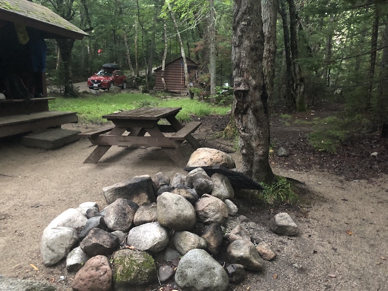
You can pick between tent sites and lean-to sites, and I recommend the latter, because they’re on the brook. You get a basic wooden shelter with a platform for each site, plus a picnic table and fire pit. We loved the shelters (lean-tos) throughout Baxter, as they provided just enough protection from the afternoon rainstorms and gave us a place to roll out our sleeping bags off the dirt. They’re not enclosed, however, and you won’t be safe from mosquitos there, so you can opt to set up a tent inside the shelter (but not outside of it). Roaring Brook is cold and clear, and we loved swimming in it.


Tip: You MUST enter Baxter State Park before 8:30 pm, so time your arrival accordingly. Also, the entirety of Baxter is ‘carry out’ for all your trash, so bring trash bags and plan on storing your trash in your car at night. You must also stow away all your food at night.

Day 2: Hike Mount Katahdin

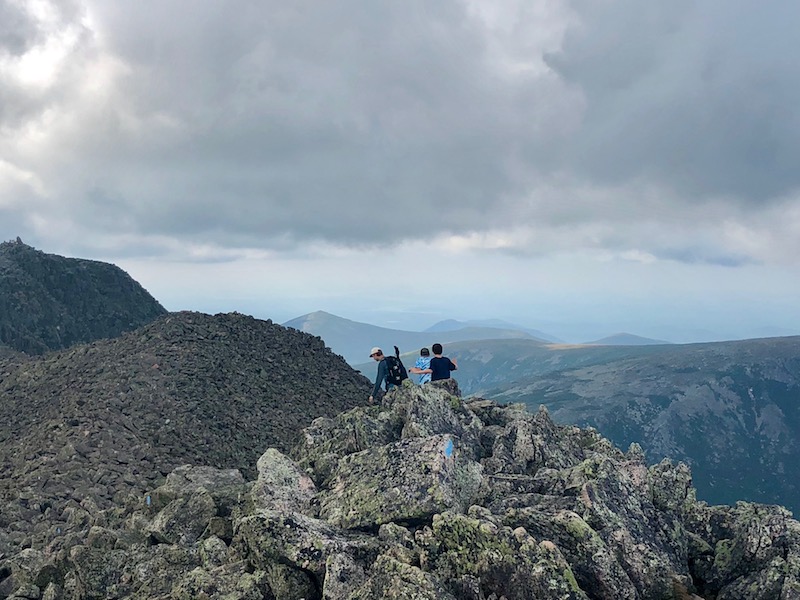
If summiting Mount Katahdin is on your to-do list in the park, do it early in your trip, while you’re still fresh. It’s 5.5 miles (pretty much straight up) from the Roaring Brook Campground, and it took our family (seasoned hikers) 12 hours to complete. The trail is extremely strenuous, and the final mile of the summit hike is along a ‘knife edge’ with some scary-looking drops. If you go: bring tons of water, and a means to filter more on the trail (you’ll need it). Also bring headlamps in case you’re caught hiking after dark. We took the following route: Roaring Brook to the Helon Taylor Trail, to the Knife Edge, to the Saddle Trail, to the Chimney Pond to Roaring Brook trail. It was 11 miles that took us forever to complete.

Note: Kids under age six are NOT ALLOWED above the treeline at Katahdin, though on our visit, we did not see a ranger monitoring this. I’m told there usually are. We took a seven-year-old, my niece, who rocked it, but she’s unusual in her awesomeness.

If you don’t want to tackel Katahdin, I recommend the Chimney Pond trail from Roaring Brook (3.3 fairly strenuous miles) to enjoy a picnic lunch at Chimney Pond, which has fantastic views of Katahdin right at the base of the mountain.

Day 3: Recover from Katahdin

This is where we made a mistake in our itinerary. We didn’t give ourselves a rest day after summiting Katahdin. Stay one more night in Roaring Brook and plan on sticking around camp. Enjoy the swimming and maybe go .2 mile to Sandy Pond, to try to spot the moose who like to hang out there at twilight. No nothing more!

Day 4: Head into the backcountry

If you’re prepared for backpacking in Baxter, depart Roaring Brook today, hitting the Russell/Sandy Stream trail. The destination: either Russell Pond Campground with lean-tos (7.2 miles away), or, if you don’t want to go quite so far, reserve at Wassataquoik Stream, which offers several more lean-tos with great swimming (5 miles away). If you’re ambitious, you could aim for Wassataquoik Lake, 9 miles distant, which doesn’t have a campground but does have several more lean-tos. Russell Lake has a staffed ranger office and lean-tos, a bear line, and pit toilets, and we settled in at two of them, adding a tent site for our group of 10.

Note: Baxter State Park is VERY strict about group size and where you can camp. This is a good thing, as it eliminates big groups in campsites they don’t fit into. If you reserve a lean-to made for four, you can ONLY have four people sleep there. Ditto for six-person lean-tos and tent sites.

At Russell Pond, you can use the provided canoes at the dock for a small fee (I believe it was $1/hour, on the honor system) and you can swim, though we don’t recommend it (there are many leeches here). It is, however, a good place to spot moose. The Wassataquoik Stream lean-tos are better for swimming, and theWassataquoik Lake lean-tos offer a bigger lake (better for swimming) and more canoes.

Alternatively, you could backcountry camp at Chimney Pond instead of Russell Pond (see description above). It’s a shorter distance, though a rockier trail.

Day 5: Day hike from Russell Pond

We enjoyed hanging around camp and day hiking from Russell Pond to Wassataquoik Lake (2 miles) on this day. We played board games and cards in our lean-tos, picked blueberries in the wild patches nearby, and tried to spot moose.

Day 6: Hike back to the frontcountry

Return to Roaring Brook today, and spend the late afternoon cooling off in the brook. Pack up and depart Baxter the next morning, checking out additional parts of Baxter if time allows. We recommend Blueberry Ridges or Ledge Falls if so, and if not, hit a last swim spot just outside the park boundary at Togue Pond. You can grab a nice sandwich and some souvenirs from the North Woods Trading Post just outside the park toward Millinocket, and if you want a bigger meal, we recommend the friendly and affordable Sawmill Bar and Grill.

How to reserve your campsites:

Baxter State Park is popular, and as mentioned, entry is limited. To ensure you get your campsite, reserve far in advance. Baxter uses four month rolling reservations, so you’ll want to reserve exactly four months before you desired time. You can reserve online or by phone.

More tips:

  • If you’re day hiking Katahdin (staying in Millinocket), you’ll want to reserve your parking space (these are limited as well!). Here’s how. Parking reservations are only held for you until 7 am, then are given away on a first-come, first-served basis. Yes, you really need to start that early. If you’re camping in the park, you don’t need a parking reservation.
  • You’ll need to treat ALL your water in the park. Bring a good filter. We like the Sawyer Squeeze to bring on day hikes and the Platypus GravityWorks for in camp.
  • You cannot bring firewood into the park. You must purchase it in camp.
  • No pets are allowed, even in car camping campgrounds. Plan accordingly.
  • Check in at every ranger station as you hike. Bring a phone and treat it as an emergency device (you won’t get service in the park anyway).
  • Pack out all your trash…make it easier on yourself by reducing packaging on your food before you arrive. Store all food and trash in your car at night in the frontcountry, and on bear lines in the backcountry (use your sleeping bag stuff sacks to store food and hang it from the line provided).
  • Backcountry campgrounds DO include pit toilets with toilet paper. They were all in good condition during our visit.
  • Enjoy the Maine wilderness!


Visiting Hot Springs State Park, Thermopolis Wyoming

Approximately two hours outside of Cody, Wyoming and 2.5 from Yellowstone National Park, the town of Thermopolis Wyoming plays host to Hot Springs State Park, the oldest state park in Wyoming. Families may find themselves passing through en route to either aforementioned destination, and Thermopolis’ unique attractions make it an excellent pit stop.

hot springs state park

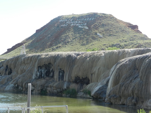
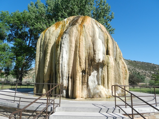
Upon entering Hot Springs State Park, you’ll set aside any pre-conceived notion that as a state park and historical landmark, the hot springs will be removed from commercialism. Since 1900, Hot Springs State Park has been a tourist destination in its own right, and remains an attraction first, historic site second. The state park is right near town, with several motels on the grounds. The main draw is the geothermal hot springs, which, since 1900, have been piped into several area bath houses and pools. As you drive through the state park grounds, you’ll notice several large beehive-shaped mounds: these were once teepees erected around geothermal springs to capture their steam, and are now covered with a century of sulphuric residue.

Hot Springs State Park pools:

Hot Springs State Park

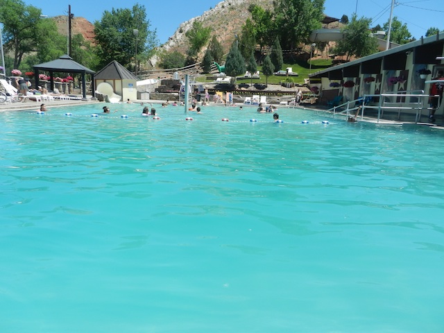
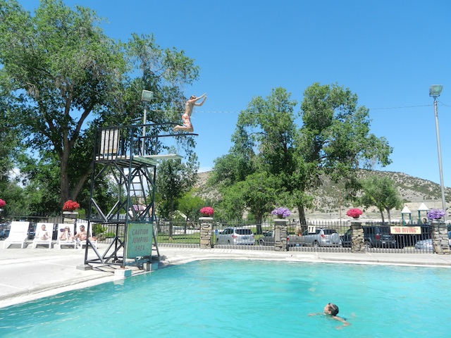
There are two main hot springs’-fed pool complexes on the state park grounds, both open to the public. The Teepee Pool is the lower cost option, used predominately by locals, according to the locals I queried. It includes an indoor and outdoor pool, one slide, and soaking tubs. The more expensive but more extensive Star Plunge Pool includes indoor and outdoor pools, soaking hot tubs, three slides, a kiddie pool, and a high dive. We opted to spend our day here, and were not disappointed.

Star Plunge

Walking into the Star Plunge, one might think they’re entering a bowling alley or skating rink of the ’70’s. The dark interior sports a small selection of video arcade games, and next to the ticket counter is a ‘self serve’ snack bar of candy, chips, and sodas. Once past the front counter, there are locker rooms that lead into the large indoor pool. Be ready to be assaulted by the smell of sulphur: this is the real deal!

hot springs state park

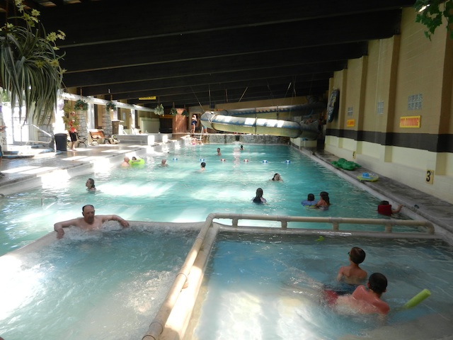
The indoor pool consists of several soaking whirlpools attached to the main indoor pool, plus a hot tub that can reach 104 degrees. The main pools are approximately 90-94 degrees. There’s an interior hydro-tube slide called Blue Thunder Run that deposits riders into a flume adjacent to the indoor pool, and the 21-and-old Vapor Cave leads you to a naturally-made sauna cut into the rock of the mountain upon which the Star Plunge is built. Bubbling hot springs water continually flows here, creating intense steam. I like saunas, but could not stand the heat like some of the locals can!

Outside another large pool beckons, with a small children’s slide called the Lil’ Dipper that’s still pretty intense at 60 feet, a kiddie pool above it, and a diving board. There are plenty of deck chairs and extra sun decks above the kiddie pool. Access to the largest slide, an outdoor half-tube called the Super Star 500 is inside next to the enclosed tube. Riders walk up a very steep path to the top after grabbing a mat to slide down on. The water pressure at the top is quite intense (2,400 gallons per minute), making the slide intimidating for young kids (it can be tricky to get yourself on your mat and sit down without taking off prematurely!).

indoor pool at star plunge

There are at least 27 different minerals in the water at Star Plunge, and while they’re no longer considered to be medicinal, there still is an exercise and massage facility on-site. Plan to spend at least 2-3 hours here to enjoy it all, taking breaks from the water to soak up the sun in the summer. The pools are open in winter, and likely very welcome during cold Wyoming days.

Other park points-of-interest:

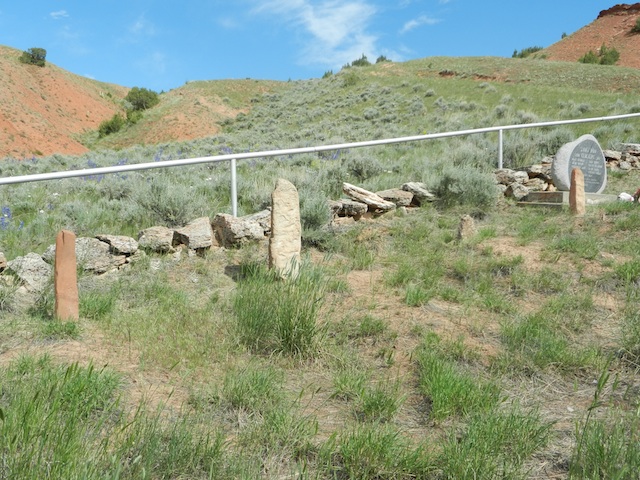
After swimming, take a few minutes to drive past the pools to a few look outs with plaques describing the thermal activity in the area. These turn-outs also have great views of the basin and the Big Horn River. You’ll learn a little more about this unique region with water literally bubbling beneath the surface, and it only takes a few minutes. There’s a drive where American bison (buffalo) still roam (though we didn’t glimpse any) and a small pioneer graveyard that’s of interest.

hot springs state park

hot springs state park grave

Date last visited:

June 2013

Distance from the interstate:

On Highway 20.

Admission price:

There is no fee for Hot Springs State Park. Admission to Star Plunge is $12.50 for adults and kids (5 and older) and $6 for kids under five. Senior rate is $10.
Hours of operation:

The state park is sunrise to sunset, and the Plunge is 9 am to 9 pm. Families can rent inner tubes and beach balls on-site for a few dollars.

Dining:

While the Star Plunge operates a grill on some days, usually only snacks are available. There’s no outside food in the pool area, but a picnic area is located on-site (get your hand stamped before leaving the pools) and there’s a large park across the street. Bring a picnic!

Directions:

Star Plunge is located at 115 Big Spring Drive (the state park address is 538 N. Park). After entering Thermopolis, simply follow signs to Hot Springs State Park. You can’t miss it!
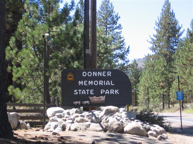
Donner Memorial State Park and Emigrant Trail Museum

As Northern California natives and Oregon residents, we’re well-versed in Oregon Trail pioneering history, and specifically, the Donner Party. We’ve taken the kids to Sutter’s Fort State Park in Sacramento, CA, where they first learned about the ill-fated party, and when we found ourselves on Interstate 80 at the beautiful Donner Summit during our Thanksgiving break travels, we just had to make a pit stop at Donner Memorial State Park and Emigrant Trail Museum in Truckee.

In warm-weather months, the park features lakeside access, well-tended picnic grounds, and hiking trails, but it’s still very worthy of a visit in winter. The Emigrant Trail Museum features extensive displays depicting the Donner Party ordeal, and includes exhibits describing general pioneering ways: wagons, tools, maps of established trails, and the like. Most interesting is the video (shown on the hour) and the short walk (accessible even in early winter) to the site of one of the Donner Party cabins. The kids found it fascinating that it was still possible to see the discoloration on the granite slab that served as a cabin wall, caused by chimney smoke. The nearby Donner memorial statue is also worth a look: the pedestal (base) of the memorial illustrates the height of the snowfall during the winter the Donners spent below the summit.

Tip! If you’re visiting in winter, you might want to consider stopping to sled or snowshoe near the state park at the sno-park by Boreal (a few miles south on I-80).

Date last visited: November 2011

Distance from the interstate: Directly off I-80.

Admission costs: $8 per vehicle, payable at a self-pay station or within the museum. Note: cash only!

Hours of operation: The museum is open 9 am to 4 pm, year round. State park grounds are open sunrise to sunset.

Directions: The park is 100 miles east of Sacramento via Interstate 80, and is within the town of Truckee, just west of downtown on the south side of the freeway.

Reed Bingham State Park

542 Reed Bingham Road
Adel , GA

Not quite ready to let go of summer? Reed Bingham State Park “is about three and a half hours from Atlanta…if camping isn’t your thing, it’s also a good place to just get off the road for a bit to stretch your legs, enjoy a picnic or even squeeze in a game of mini-golf. In addition to mini-golf, Reed Bingham has a nice playground, beach and boat docks. They also rent bicycles and canoes and offer pontoon boat tours. It’s an excellent place for bird watching or learning more about the resident gopher tortoises. The park staff rehabilitates various animals that are orphaned or left on the property. We were lucky enough to see a hummingbird, bluebird, red-headed woodpecker and even a bobcat kitten!”

Review courtesy of Sue from Field Trips with Sue.

Date last visited: August 2009

Distance off the interstate: Less than 6 miles off I-75.

Hours and Admission Prices: $5 park entrance fee per car (camping fees start at $23)

Website: Reed Bingham State Park

Directions: 6 miles west of Adel on Ga. Hwy. 37 via I-75 exit #39, and 14 miles east of Moultrie from U.S. Hwy. 319.

Alfred B. Maclay Gardens State Park

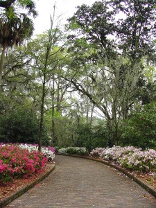
Brick path leading to the Maclay house. Photo courtesy of Florida State Parks.

Brick path leading to the Maclay house. Photo courtesy of Florida State Parks.

3540 Thomasville Rd
Tallahassee, FL

Alfred B. Maclay Gardens State Park is a wonderful place to get out and stretch your legs during a long trip. During blooming season, flowers paint the walk with beautiful colors and during the off season you can see every shade of green, says Jennifer of Two Kids and a Map, who brings us this review. I was on a road trip from Pensacola to Jacksonville, Florida with my two children by myself and we desperately needed a pit stop! The kids were getting hungry and anxious and I was tired of listening to the whining. Unfortunately, the exit I chose is awful for quick interstate stops. There are several lanes of traffic and it is difficult to turn around to get back on the Interstate. I spotted the trademark Florida State Park sign and followed it to the entrance. It was a perfect stopping place for us. The children got to run along the path of the gardens and burn off some steam. There was so much to look at: a hidden garden, a lake and a pond, and the beautiful home. The kids enjoyed looking for bugs and eating a picnic lunch on the grounds before we got back on the road.

Date last visited: July, 2009

Distance off the interstate: Approximately 1 half mile off of Interstate 10.

Hours and Admission Prices: $6.00 per vehicle to enter the park. During the blooming months, it is an additional $6.00 an adult and $3.00 a child to enter the gardens. However, during the off season (May through December) touring the gardens is free.

Bathrooms and Food Services: Bathrooms are available and there are picnic areas if you bring your own meal

Other tips: Be sure to get your Real Florida Passport stamped while you are there. You can walk down to the house and back in about 30 minutes if you do not stop too many times!

Website: http://www.floridastateparks.org/MACLAYGARDENS/

Directions: Located one half mile north of I-10 on U.S. 319
View Larger Map

McArthur Burney Falls State Park

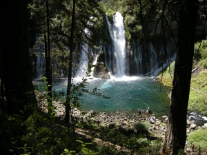
The inviting pool at the base of the falls.

The inviting pool at the base of the falls.

24898 Hwy 89
Burney, CA

McArthur Burney Falls State Park is one of the nicest state parks I’ve run across in a long time. In northern California’s volcanic country near Lassen National Park, it sits directly on Highway 89 near Burney. After you enter the park, you’ll find a large, shaded picnic area to your right, with parking to the left. Follow the signs to the Burney Falls overlook for an amazing view. 129-feet high, Burney Falls is stunning (and dumps 100 million gallons of water a day!). The 0.3 mile walk to the base of the falls is well worth it; at the bottom, enjoy the soft spray or dip your toes in the freezing water. The basin is a beautiful blue. There’s a loop trail to try if time is permitting (1.3 miles), or just retrace your steps back to the top (0.6 round trip). We picnicked at a nearby table, but wished we’d had enough time for a swim in nearby Lake Britton.

Date last visited: July 2009

Distance off the interstate: Located directly on Highway 89, or six miles north of Highway 299.

Admission Prices: $6 per car for day use.

Bathrooms: Located across the street from the day use parking. They looked brand new.

Food Services: A nice general store with all the necessities, plus soft serve ice cream!

Website: http://www.parks.ca.gov/?page_id=455

Directions: Take Highway 89 near Burney. (From Redding, go north on Hwy 299 past Burney and follow signs.)

View Larger Map

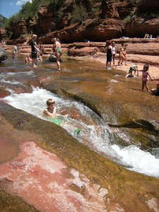
Slide Rock State Park

Slide Rock State Park, July 2009

Slide Rock State Park, July 2009

6871 N. Highway 89A
Sedona, Arizona

Slide Rock State Park may be a bit further off the beaten path than most pitstops (18 miles from Flagstaff), but it’s a mere five miles from the popular vacation town of Sedona, and well worth any amount of effort.

Slide Rock State Park planning:

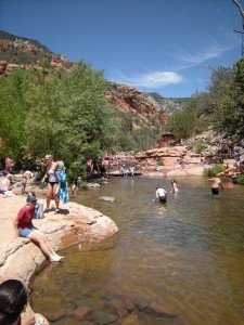
Located down Highway 89A along a particularly scenic stretch of Oak Canyon, Slide Rock State Park is exactly what it professes to be: a slippery, natural waterslide. Upon first sight, my kids were awestruck, and quite frankly, so was I. At least a quarter mile of the river is cut so perfectly out of the red rock canyon, it appears man-made. The water pools and eddies around smoothly rounded slabs of granite, creating both slick slides and deep diving holes.

Nate, sliding down a shute.

Nate, sliding down a shute.

There’s about a quarter mile walk from the parking lot to the swimming site. It’s easy to access, but bring good water shoes. I know this is simply common sense, but the rocks are very, very slippery. We fell many times, and saw worse. There’s very little shade, and not much room on the slabs of stone for chairs. We opted to bring only beach towels and a cooler with cold water, which worked out great. We didn’t spend much time out of the water, anyway!

Date last visited: July 2009

Distance off the interstate: 18 miles off I-17 on Hwy 89A from Flagstaff; five miles from Sedona.

Hours and Admission Prices: Slide Rock is a state park, and entry is $10 per car or $2 per person. Hours are sunrise to sunset, but be advised: the park becomes very crowded on hot summer days, and when the parking lot fills, the park is closed. We visited on a Tuesday in July, and were one of the last cars admitted at 11 am. Get there early!

Bathrooms: Near the parking lot.

Food Services: There is a small general store located near a historic homestead en route to the slide (after the parking lot). It was well-stocked with cold drinks, ice cream, and snacks, but don’t plan to get a full lunch here.

Website: http://azstateparks.com/Parks/SLRO/

Directions: From Sedona: Head north on AZ-179 toward Sombart Ln. Turn left to stay on AZ-179, then turn right at N Hwy-89A/AZ-89A.

From Flagstaff: Take AZ-89 toward Sedona. Turn left at S Hwy-89A/AZ-89A. Turn left at N Hwy-89A/AZ-89A.


View Larger Map